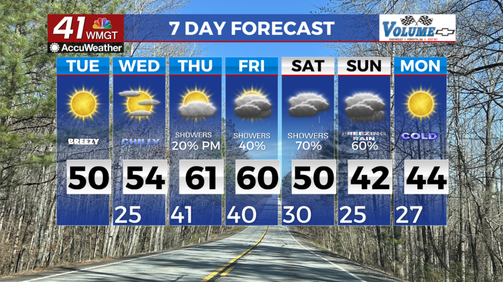
A cold start to Tuesday
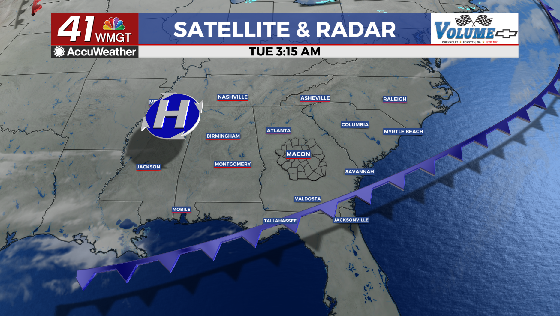
MACON, Georgia (41NBC/WMGT) – A surface high settles over the Southeast U.S. today. The high will be accompanied by a deep pool of very dry air and a boundary layer mixing in the afternoon that favors low humidity. Model guidance suggests low dewpoints across most of the region.
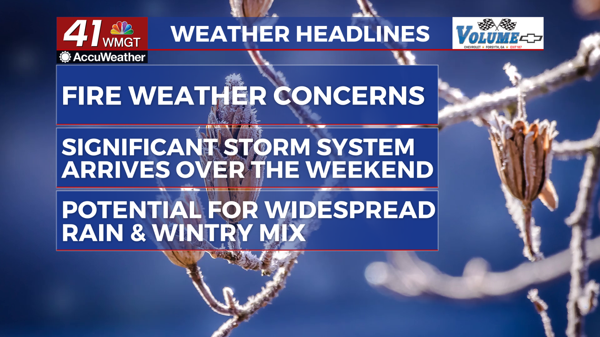
Expect widespread relative humidity values in the teens this afternoon. Don’t be surprised if portions of north Georgia dipped into the single digits. From a fire stand point, the recent rain and snow has added some moisture to fuels. Winds will also be tame.
These factors will allow for only a Fire Danger Statement to be possibly issued.
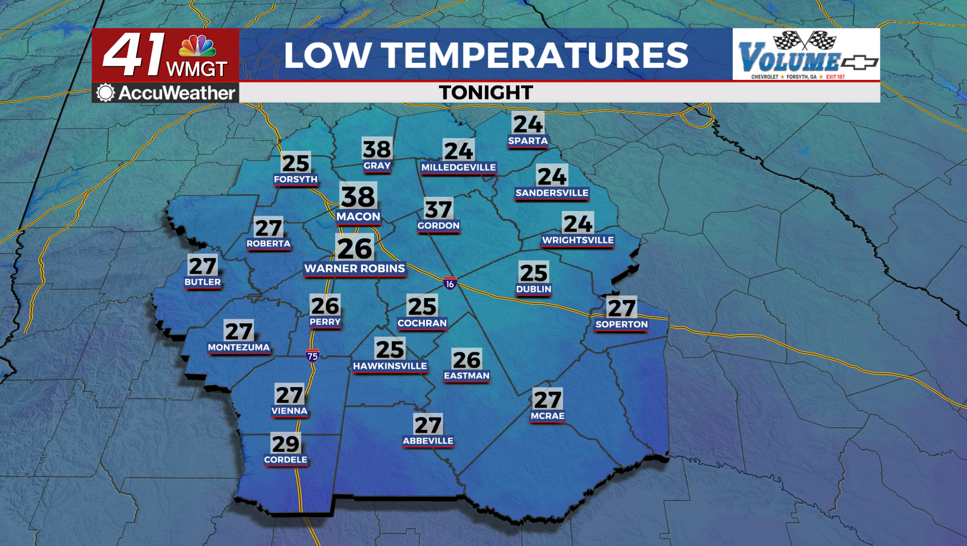
For Tuesday morning, temperatures should be in the upper teens in northwest Georgia and lower 20s across Middle and eastern Georgia. This will result in feel like temperatures in the teens for most between the hours of 5 AM to 9 AM.
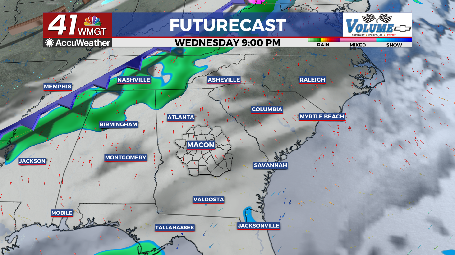
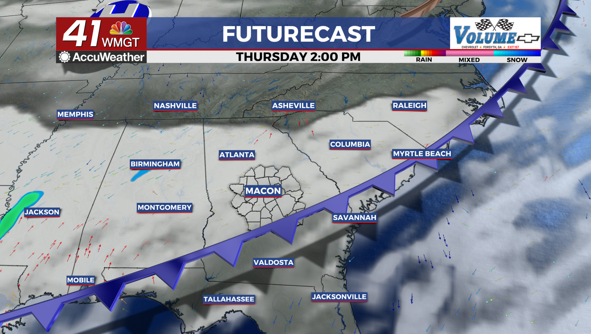
Wednesday will be the last dry day before a significant pattern change brings rain chances Thursday and Friday, and the potential for frozen precipitation this weekend. Expect low level flow to turn southwesterly and advecting in moisture as a shortwave trough traverses the Ohio River Valley.
This setup supports a slight chance of rain showers on Thursday and Friday.
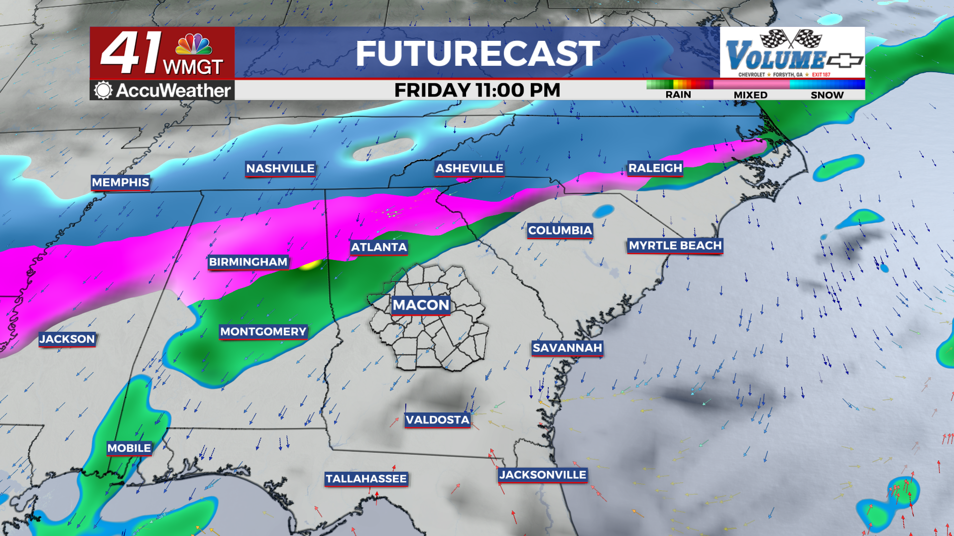
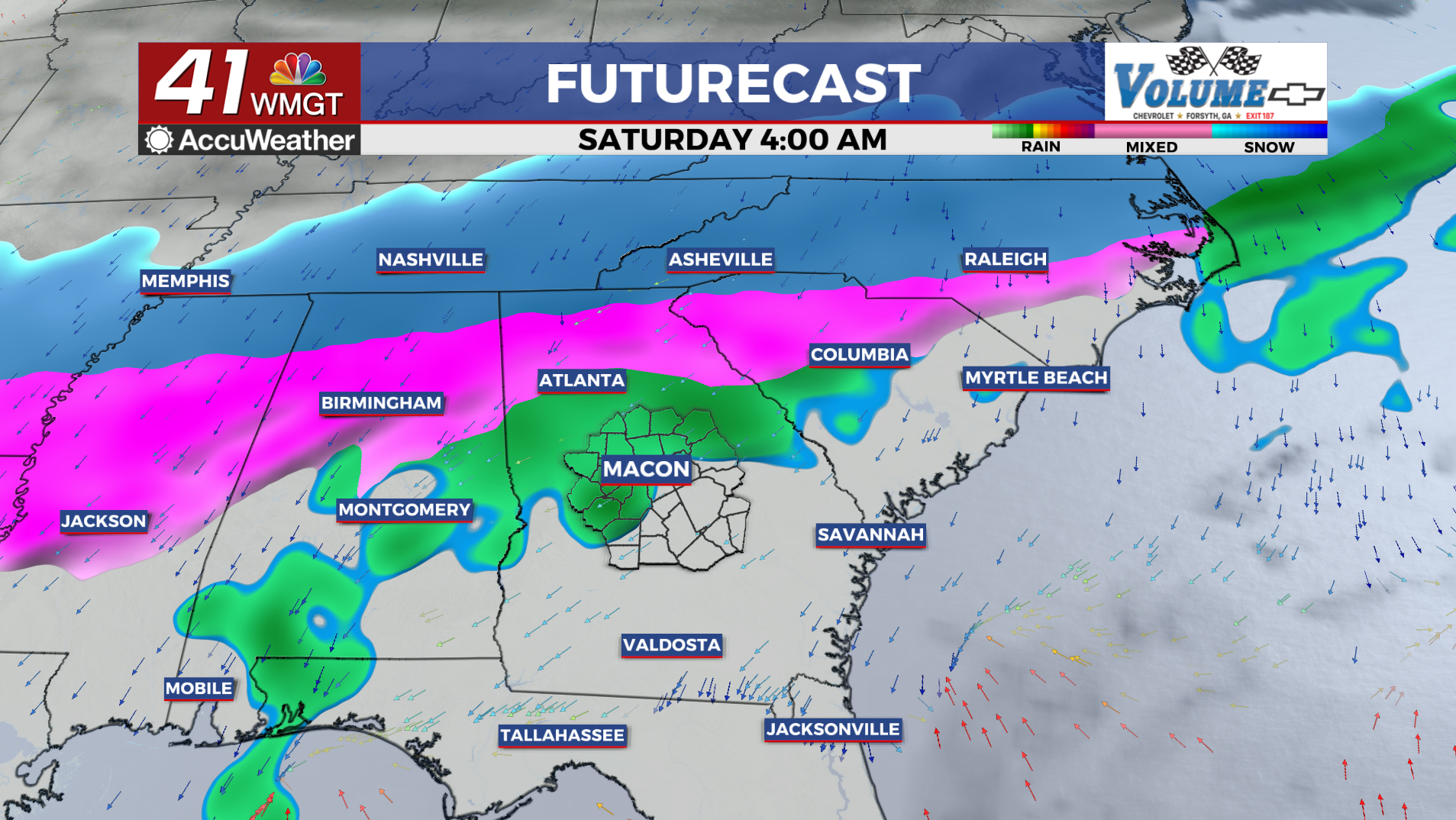
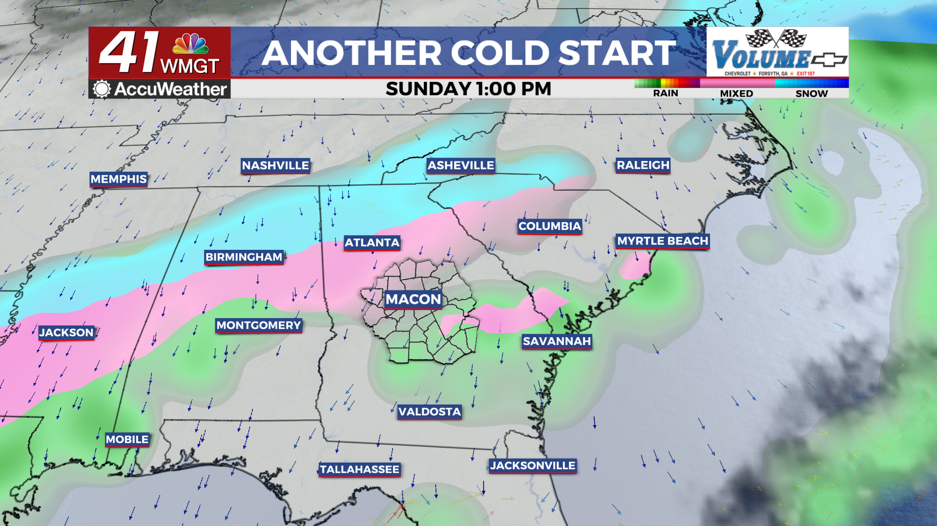
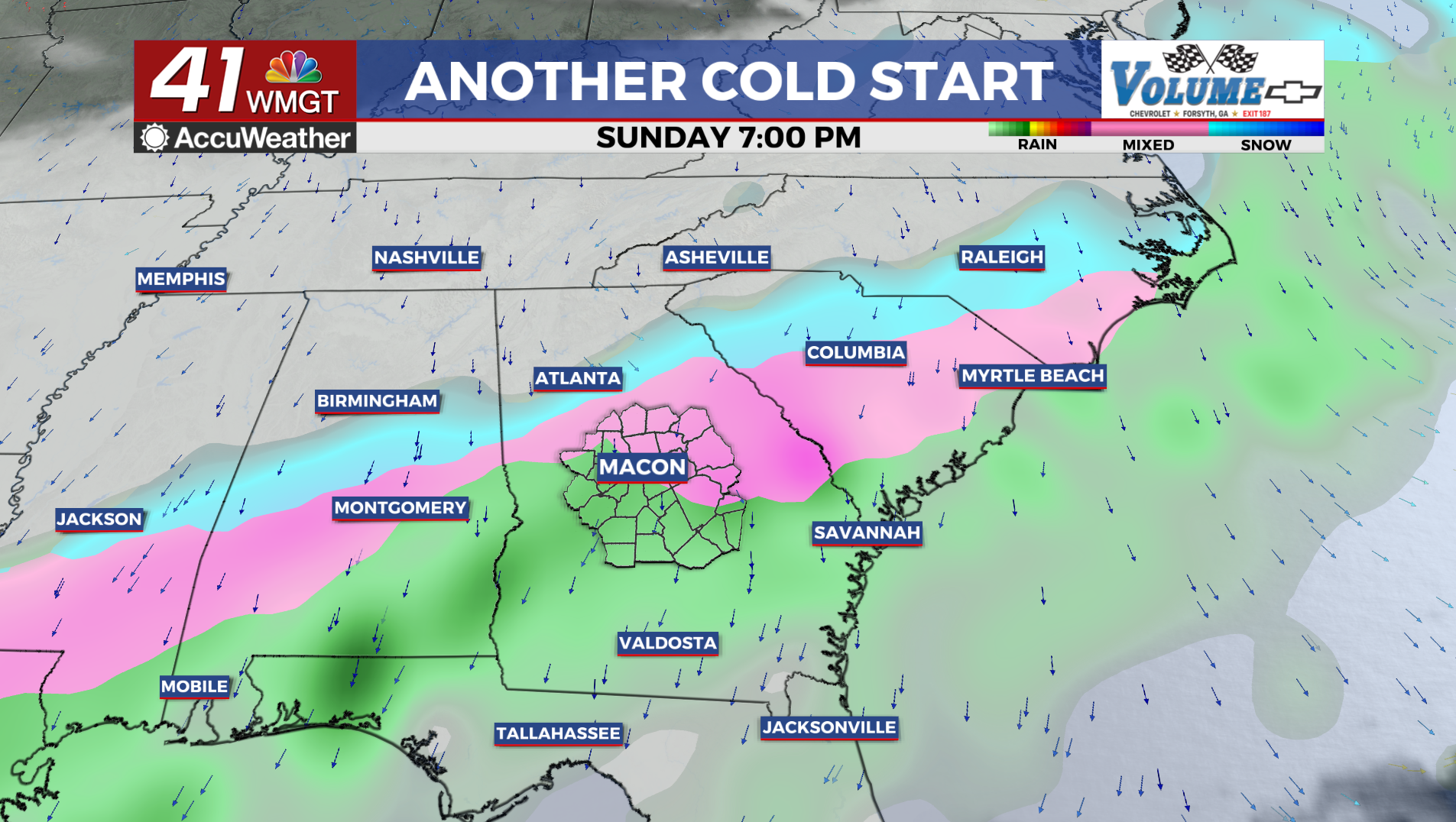
Models are putting together a concerning picture of what this weekend could look like, with an increasingly strong signal for ice storm potential across portions of our area. An Arctic airmass spills southward from Canada across the central and eastern U.S., reaching as far south as the Gulf Coast states. Gulf moisture meeting up with and overrunning this cold airmass suggests the potential for a large, east to west oriented corridor of wintry precipitation across the Gulf Coast and Eastern Seaboard states.
Where exactly this boundary between the cold, dry arctic air and warmer Gulf air sets up will govern where precipitation transition zones are located. The big picture at this point is that impactful wintry weather is possible this weekend, and the public should monitor the forecast closely through the week. Changes to the forecast are likely, so do not focus on accumulations or timing of the precipitation type transitions at this time.