After a foggy start, a brief warm up
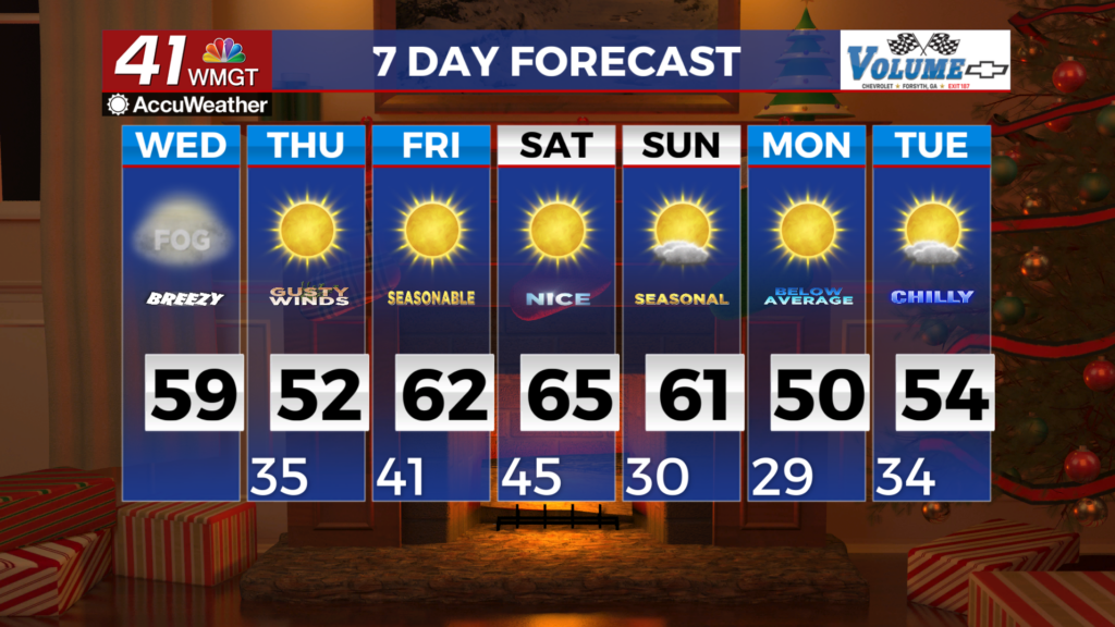
MACON, Georgia (41NBC/WMGT) – Through 10 AM today the main forecast challenge involves the potential for fog in Middle Georgia. Fair skies and light winds in the region have led to 


strong radiational cooling and areas of ground fog development. The satellite image shows that the fog is most concentrated along the river valleys, however, it is showing up in other locations as well. Travelers should use caution this morning, as low lying areas may see rapid reductions in visibility. Gusty westerly winds will develop later today ahead of an approaching cold front. Winds this afternoon should favor gusts in the 20 to 35 mph range at the surface, and it would not be surprising to see a couple gusts over 35 mph at the more exposed areas. The winds should turn northwesterly overnight as the cold front passes, and the winds may remain elevated, especially in North Georgia through the overnight hours. Temperatures will surge into the upper 50s in North Georgia, and lower 60s in Central Georgia today. A cooler drier airmass moves into the region tonight. This will bring high temperatures down by about 10 degrees on Thursday.