

Rain starts off the new week
MACON, Georgia (41NBC/WMGT) – The overnight into the Monday morning hours will bring quite a temperature difference from north to south across the coverage area, with lows in the upper 


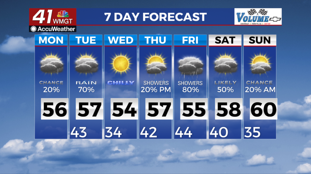
 20s to upper 30s roughly along and north of the I-85 corridor, and in the 40s south of the area. Isolated rain may persist overnight, however, we are expecting that precip will occur south of where temperatures will be freezing. Similar to today, highs tomorrow will be much cooler across north Georgia than across Middle Georgia. Another wave of rain is expected to arrive Monday evening and last through the overnight hours as a Gulf low approaches from the southwest. The placement of the low largely to the south of the area will likely support bands of moderate to heavy rainfall, and depending on where the bands set up, localized flooding cannot be ruled out. The long term forecast picks up Tuesday where waves within the northern and southern branch of the jet stream will be passing by the region and dragging the cold front through us. This will bring an end to the rainfall. Some showers could linger into the late morning to early afternoon before clearing occurs. Tuesday night into Wednesday morning looks chilly, with lows in the 20s and 30s thanks to clearing skies. Ridging builds overhead in the southern branch of the jet, keeping us clear on Wednesday with highs in the 50s across the region.

