Dry start to the short work week, then showers arrive for Tuesday
MACON, Georgia (41NBC/WMGT) – The satellite loop shows mostly clear skies across the state and it should stay that way through at least Tuesday. We could see some fog across north and 


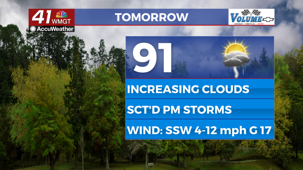
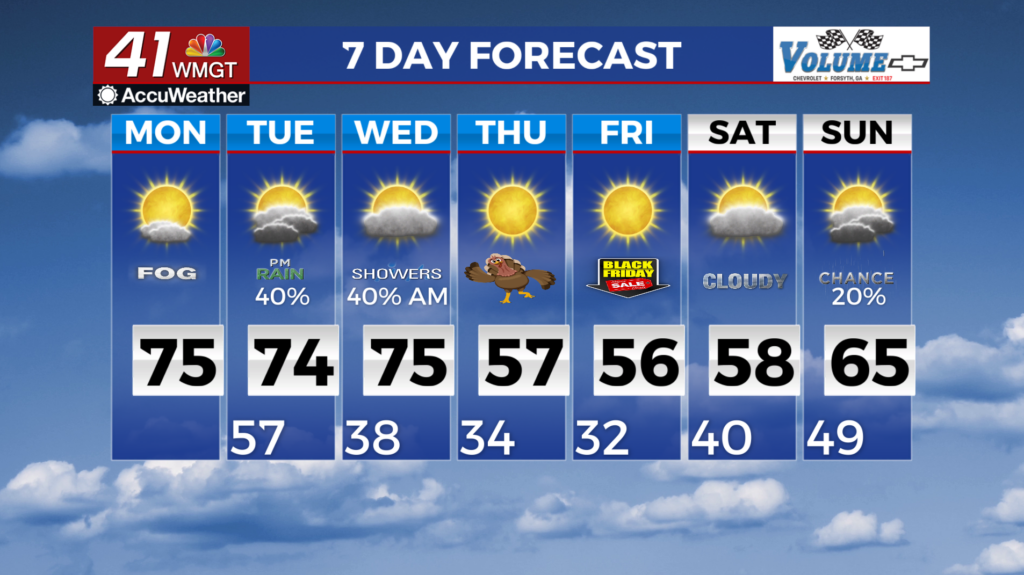
 Middle Georgia just before daybreak today, but it should dissipate by 9 to 10 am. High pressure centered over western Tennessee and Kentucky moves east over the next 24 to 36 hours moving off the Mid-Atlantic coast by Tuesday. This ridge is what is currently keeping things dry over the southeastern U.S., but as it moves east we will get into a more moist east to southeast flow Monday/Monday night. This ridge will push out of the way and allow the next frontal system to move into our area. This frontal boundary is currently developing over the 4 corners region with its main low center expected to be over Southwest Kansas by midnight Monday night. Its associated cold front moves into the lower Mississippi River Valley Monday evening with precip pushing into Northwest Georgia around 9 pm Tuesday. We are only expecting showers Monday night as this front nears the area, we could hear some thunder into the extended period with this system. Temperatures continue on the warm side with lows tonight in the upper 50s to near 60. Highs Monday will mainly be in the 70s with some lower 80s across Middle Georgia. Ensemble models continue to come in better agreement with midweek rainfall and cooldown late in the week. Starting Tuesday morning, showers and thunderstorms will slowly move through northwest Georgia as the cutoff low moves across the Tennessee Valley. A surge of moisture will advect into the region and the onset of rain is slated to occur as early as Tuesday morning across portions of Northwest Georgia. This low deepens on Tuesday as it continues northeast which will act to sharpen the front as it advances towards the state. Timing will be key as we are analyzing the severe threat. Models continue to move the line eastward and slower to allow for increased daytime heating. A Marginal Risk (level 1 out of 5) could be introduced for areas north of I-85. Temperatures will remain warm and mild through Wednesday with highs ranging from the upper 60s in North Georgia to upper 70s near 80 across Central Georgia. Daytime temps in the 50s to low 60s and overnight lows near freezing return by Thanksgiving through the end of the week in the wake of the front.