A few showers to start the weekend
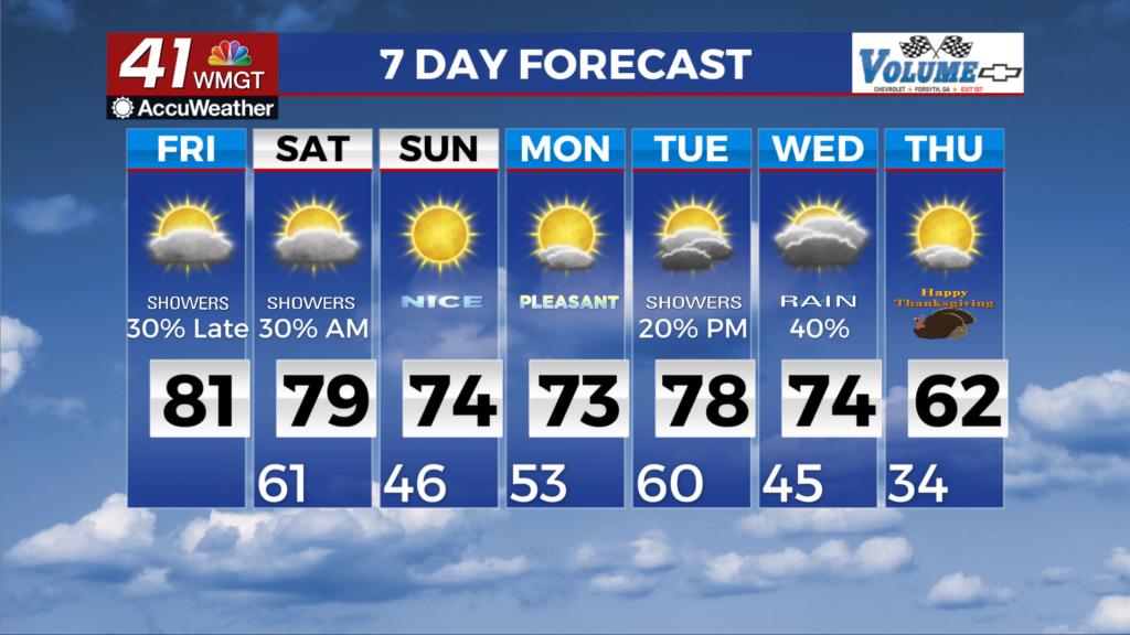
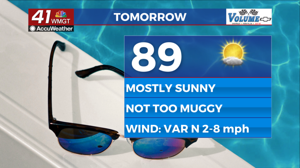
MACON, Georgia (41NBC/WMGT) – As we start off Friday, above-normal temperatures precede late evening showers. Models suggest areas of fog and low clouds to be less widespread than 


 yesterday morning’s fog and low clouds, due in part to increased upper level cloud cover. Another push of rain and isolated storms is expected Friday afternoon into Saturday, with activity spreading in from northwest to southeast. Severe storms are not expected due to the lack of instability. An uptick in storm coverage will be possible Friday overnight into early Saturday morning ahead of a surface low that will be tracking across the Tennessee River Valley. Rainfall from this evening through early Saturday morning is forecast to total as little as a trace to as much as 0.75 inch. The extended period begins with the frontal boundary that moved into the area Friday night draped across Middle Georgia. We will still see some light showers and isolated thunderstorms Saturday but a drier airmass begins to push into Northwest Georgia shortly after sunrise. The actual front moves into South Georgia by Saturday afternoon however, there will still be some lingering showers across Central Georgia. Expect some wraparound moisture possible as high pressure slowly builds southeast Sunday into Monday keeping things warm and dry through Monday evening. The ridge center moves northeast through Monday night allowing the next frontal boundary to push into the area.