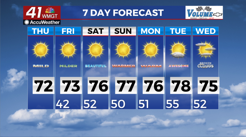
Steadily warming temps round out the end of the week
MACON, Georgia (41NBC/WMGT) – The building ridge and a surface high pressure system centered to the southwest assist in the ongoing warming trend. After low temperatures start the 


 morning in the low 40s across the region, highs will warm into the upper 60s to low 70s, which is about 3 to 7 degrees above normal. The influence of the high pressure system will inhibit precipitation chances today and tomorrow. A few locations in East-Central Georgia could see relative humidity values at or just below 25% in East-Middle Georgia, where the driest air will remain and warmest temperature are forecast, although for only a couple of hours at most both days. As we move through the weekend and into early next week, the models strongly favor above average temperatures. The passage of a poorly defined trough on Sunday could produce a slight dip in temperatures, early next week. Overall it will be unnoticed by most, as high temps should remain 8-14 degrees above average between Saturday and Tuesday. High temperatures will be in the lower 70s. Low temps should also remain mild. A lack of significant moisture in the region will greatly restrain the potential for precipitation through next Tuesday. For the trough on Sunday this will be a significant problem, and any rain potential appears to be limited.