
Warming trend starts out Tuesday
MACON, Georgia (41NBC/WMGT) – Fair and tranquil weather conditions are expected today for North and Middle Georgia as surface high pressure and the edges of another ridge become 


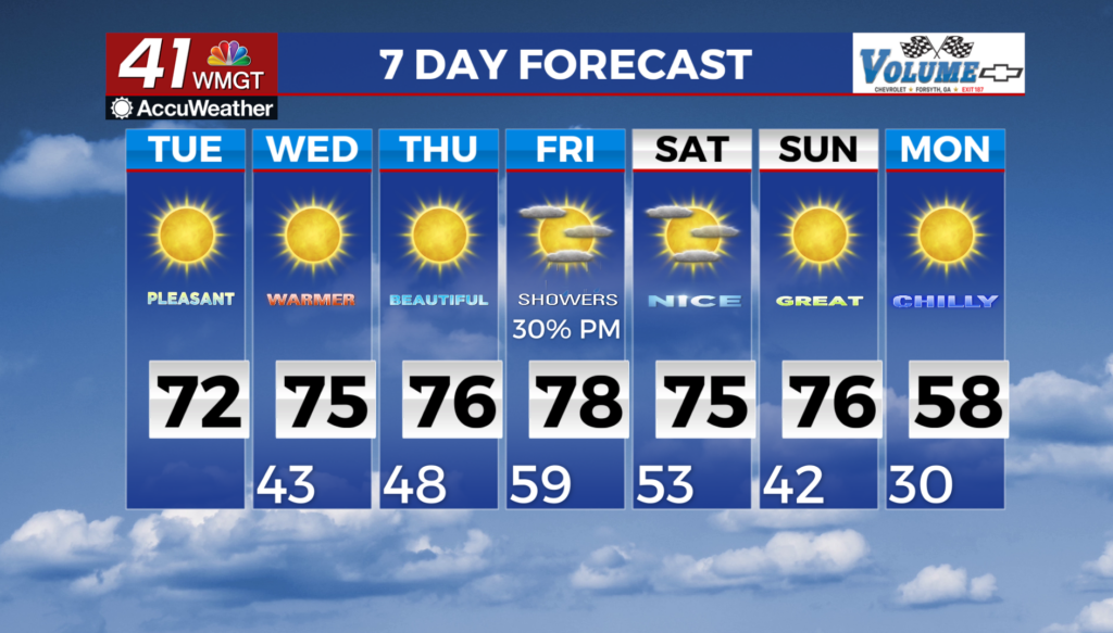
 situated across the Southeast. Under clearing skies, temperatures will climb int0 the low 70s across South-Central Georgia. Tonight, temperatures will fall back into the upper 40s areawide. There is very little change outside of some slight increase in the timing of precipitation chances over the weekend. A weak clipper system is still set to swing over the northeast U.S. Wednesday, however, it should remain north of the region. Temperatures continue warming from Wednesday through Friday as a new surface high slides in behind that clipper system. Expect highs in the 70s and lows in the 40s. Models continue to show a wave progressing through the area bringing a front into North and Middle Georgia sometime Friday night into Saturday. Some questions remain on the exact timing, strength of the front/wave, and moisture availability. Moisture return on Friday into Friday night with potential rain or cloud cover will mean warmer overnight lows. The next system on the horizon may be at the beginning of next week, which could bring another shot of cold air into North and Central Georgia with possible frost/freeze possibilities, especially in northern Georgia. It’s a little bit too far out to speak on this, however, this is mostly for awareness for those who need to make long term plans for outdoor crops.