
Fall-like weather for Saturday, then a wet warm up for Sunday
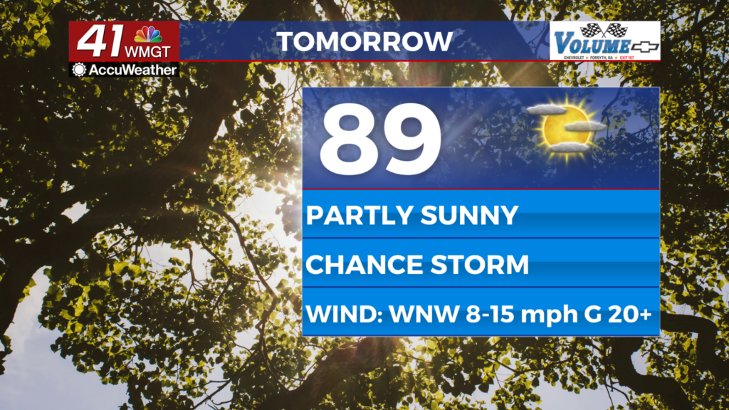
MACON, Georgia (41NBC/WMGT) – It’s shaping up to be a fabulous Friday across North and Middle Georgia. With high pressure and midlevel ridging staying put across the region, fair weather 


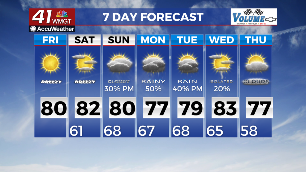
 is expected to continue through the end of the week. Temperatures in the upper 70s to low 80s and dewpoints in the 40s/50s will make for pleasant weather each afternoon. The main point of note for the remainder of this afternoon will be elevated fire conditions. Dewpoints over the next 24 to 36 hours are low. Unlike yesterday, we are a tad bit warmer today so there may be a small window where a few locations may drop to critical relative humidity thresholds (below 25%). Nevertheless, a Fire Danger Statement remains in effect through this evening. While rain-free conditions and comfortable temperatures are definitely preferred, these conditions will not help the current drought situation across much of North and Central Georgia. We will continue to monitor this trend in the coming days as rain-free conditions are expected through at least Saturday. With October traditionally being one of our drier months, it will be really interesting to see how this trend evolves not just in the short term but in the long term as well. As the long term period begins on Saturday, a large upper level ridge remains centered over the Eastern U.S., with an associated high pressure centered over the Mid-Atlantic coast. This high pressure system will keep dry conditions in place across the region for one more day, with very minimal chances for showers and thunderstorms on Saturday. Low temperatures will start the morning in the mid to upper 50s in North Georgia and low 60s in Middle Georgia. Highs are then forecast to rise into the upper 70s to low 80s.