No direct impacts from Imelda in Middle Georgia
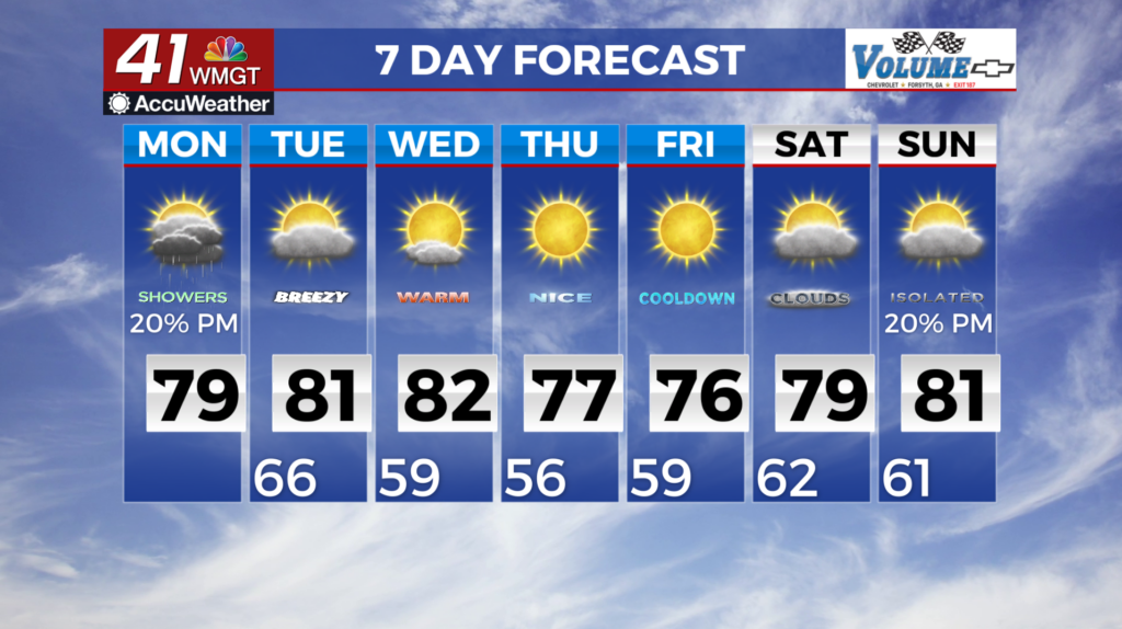
MACON, Georgia (41NBC/WMGT) – A quiet morning to start the work week across North and Middle Georgia under mostly clear skies with a light easterly breeze and humid temperatures in 


 the mid to upper 60s. These conditions are being driven by two primary features, a nearly stationary low over the Carolinas, and Tropical Storm Imelda over the Bahamas. While Imelda will not have any direct impacts on our area, it will influence the weather conditions through midweek. That begins today, as easterly flow across the region strengthens due to the influence of Imelda, and moisture pooled over the Carolinas will start to be brought into the eastern half of the state. This will lead to increasing cloud cover, however, there will only be enough moisture around to support isolated showers and thunderstorms, mainly during the afternoon and evening hours. The breezy easterly winds and high temperatures in the low 80s will make it feel a bit cooler than recent days. Tonight through Tuesday morning, the easterly winds will continue to pool low level moisture over the area and lead to humid low temps in the mid to upper 60s. Despite the moisture, rain chances will again be low, with only isolated showers and thunderstorms during the afternoon and early evening. These will be primarily focused across far north and northeast Georgia, where the midlevel low will retrograde over as Imelda shifts east into the Atlantic. The east-northeast winds will remain breezy, and high temperatures will again climb into the upper 70s to low 80s.