Summer hangs on as Fall is nowhere to be found
MACON, Georgia (41NBC/WMGT) – A wedge continues to spread across the area today. Drier, cooler air with the surface high over the Northeast U.S. that is driving the CAD (Cold Air Damming 


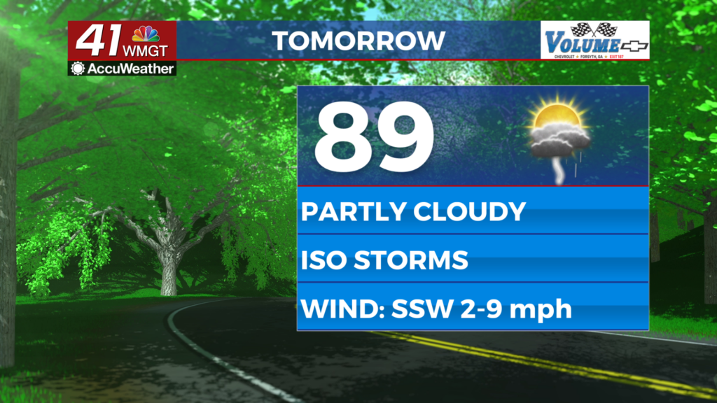
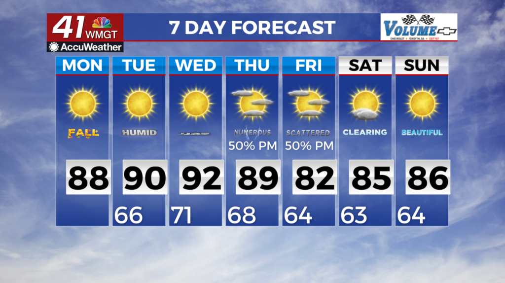
 in which cold air is trapped under the atmosphere) remains out of the coverage area. The only real influence is the easterly flow at the surface through the area and some suppression of convection. Highs this afternoon will be well into the 80s and 90s. Lows overnight will cool into the mid to upper 60s. Tuesday is looking like a bit of a carbon copy of today, with highs in the upper 80s to 90s, easterly to southeasterly winds, and the best chances of seeing a storm in northern and northwestern Georgia. A strong storm in northwest Georgia is possible with a very low chance of seeing something severe form. The long term period starts off with continued mostly dry conditions as Georgia remains under weak zonal flow on the edge of longwave troughing that covers most of the central and eastern U.S. This pattern will stick around through Wednesday, with rainfall chances generally limited far Northwest Georgia closer to the moisture associated with the longwave trough. The more noteworthy aspect of this forecast will be the heat, as southerly winds bring in above normal temperatures and elevated dewpoints. High temperatures will be in the upper 80s to low 90s, with heat index values in the low to mid 90s in north Georgia and upper 90s in central Georgia. A large shift in the pattern will start to take place late Wednesday as a potent stacked low moves into the Midwest and Tennessee Valley. From Wednesday night through Thursday, significant moisture advection downstream of the low will spread across Georgia. This will support multiple rounds of showers and thunderstorms across the area through at least Thursday night, before a cold front associated with the low pushes through on Friday. Some strong storms will be possible, but widespread severe weather is not expected at this time. This rainfall will be a welcomed relief for areas in drought status from the several weeks of little to no rainfall. After the cold front passes through, a slightly drier and cooler airmass pushes into the region for Saturday.