Slim chance for showers, then above normal temps for Saturday
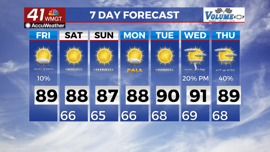
MACON, Georgia (41NBC-WMGT) – Isolated showers and thunderstorms will continue to be a possibility this afternoon. With no notable or defined features or forcing lift, zeroing in on the areas of higher rainfall potential remains quite difficult. The highest elevations in northeast Georgia generally have the best chances of seeing storms today, with orographic (mountain lift) lift helping the matter. If any storms get going, they are more likely to align with peak heating, roughly between 2 PM-10 PM. While no severe storms are expected due to lack of wind shear, daytime mixing could support an isolated downburst with winds up to 40 mph. With weak ridging sliding into the region and surface high pressure dominating the weather pattern, expect slightly warmer temperatures today. More locales are likely to reach 90 degrees compared to previous days. Highs in the 80s are favored across much of north Georgia and highs in the 70s favored in the mountains. The upper level pattern looks a bit messy over the coming week, but the overall outcome look to be a return of some better moisture and afternoon thunderstorm chances. There also is a chance of seeing a stronger upper level system pass through the area towards the middle to end of the next week, which would bring even better chances of much needed rainfall across the area, though uncertainty is high.