Meager shower possible as dryness continues
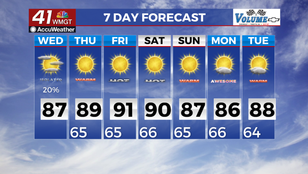
MACON, Georgia (41NBC/WMGT) – A closed low over the Mid-Atlantic will fling multiple weak shortwaves through the state today. The initial wave tracks through north Georgia this morning, 


 leading to an increase in convection between 4 AM and 10 AM. Instability will be very marginal . Any storm or shower activity should be at most widespread along I-20. Some rainfall is anticipated in the Atlanta metro area. A second shortwave will drift south along the Alabama/Georgia border this afternoon. This feature should be weaker than this morning’s wave, but it will align better with the peak in daytime heating. There should be enough instability to produce isolated thunderstorms, especially between 4 PM and 10 PM. The lack of shear suggest little to no severe threat. Therefore, lightning will be the main threat with any storm. Today’s high temperatures will be 3 to 6 degrees above seasonal averages and nearly identical to what occurred on Tuesday. Widespread highs in the upper 80s are anticipated, with a few spots touching 90 degrees in Middle Georgia. The low in the Mid-Atlantic will drift towards the Northeast on Thursday. As this occurs, temperatures will climb slightly. Look for afternoon highs that are 5 to 9 degrees above seasonal averages. This will translate to highs in the low 90s in Middle Georgia and upper 80s to lower 90s in north Georgia. No rain is expected in the state on Thursday.