Very slim chance of rain for the new week
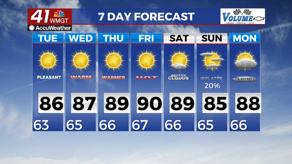
MACON, Georgia (41NBC/WMGT) – The cutoff upper low over the southeast will continue to provide weak convection support for the surface low off the Carolinas. Very weak moisture wrapping 

 around the low may reach the far northeast Georgia mountains each afternoon through Wednesday, although precipitation chances remain below 20%. No appreciable rainfall is expected with this system. As we move into the mid to late week, the upper level weakens and moves northeastward. Ridging briefly strengthens and temperatures climb to near 90 degrees by Friday before the upper level wave breaks and drives shortwave energy across the eastern U.S. While we could see some precipitation with these shortwaves, moisture will be limited to whatever dredges may be transported out of the middle Mississippi and southern Midwest. Models continue to indicate precipitation of around 20 to 30 percent on Saturday, however, precipitation chances this weekend (including Friday) will likely flip-flop over the coming days. Any precipitation that does will also likely not be widespread or soaking in nature. Limited precipitation and warm/sunny days have primed much of the area, especially western Georgia, for rapid drought conditions over the coming days and weeks. Without a widespread and soaking rainfall soon, drought development will become increasingly likely.