The streak of dry weather continues through the midweek
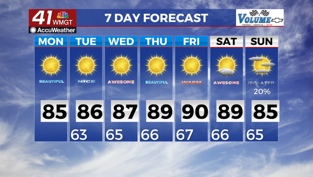
MACON, Georgia (41NBC/WMGT) – The weather in Georgia will be dictated by a cut off low along the coast of the Carolinas over the next 48 hours. Wind gradients between the low and a weak 
 area of high pressure west of the Appalachians will continue to produce northeast winds in the state. These winds will move in lower dewpoints and limit the potential for convection in north and Central Georgia. Therefore, the majority of north and Middle Georgia will remain dry through Tuesday. The mid and high level moisture will combine with diurnal heating and weak upslope flow to produce a few showers in the mountains of northeast Georgia today and Tuesday. On both days showers are probable during the afternoon (between 3 pm and 8 pm). Severe weather is not anticipated due to limited shear. If you are planning a trip to the mountains, be prepared for some rain showers and possible lightning. Temperatures will remain steady through Tuesday. Afternoon highs will top out in the mid to upper 80s, and morning lows will be in the lower 60s. Higher elevations in the mountains will see highs in the 70s and lows in the 50s. Dewpoints in the 50s will keep the humidity modest and allow temps to cool quickly each evening.