
Rain chances uptick starting Thursday
MACON, Georgia (41NBC/WMGT) – Storm chances will increase through the rest of the work week across Middle Georgia.
This Evening
A warm afternoon will see a few isolated showers and storms through the evening and into tonight. Most of the region will stay dry, however. Expect low temperatures to largely be in the lower 70s accompanied by light wind from the northwest around 5 mph. Overhead skies should be partly cloudy.
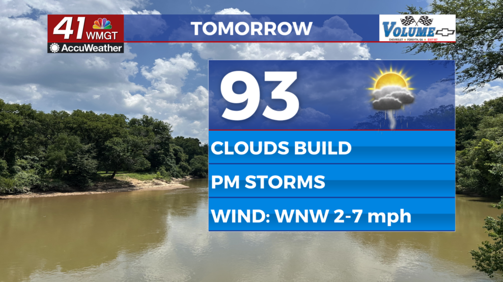
Tomorrow
Thursday should be one of the hotter days of the week as highs push towards or even above average for this time of year (been below most of this week). Real feels should reach 100+ for about half the region. Expect light wind from the west-northwest around 5 mph. During the late afternoon and evening storm chances will ramp up ahead of a surface trough that will spur on more rain for Friday and Saturday. Nothing severe is expected however the strongest storms may have decent gusts.


Overnight some rain will continue as the wind will be light and variable. Expect lows in the lower 70s once again for most of the region. Skies will be partly to mostly cloudy overhead.
Friday and Beyond
Friday looks to be pretty messy as storms should fire up in the late morning/lunchtime hours, continuing off and on through the afternoon and the evening. Anyone with Friday plans should make sure to grab the rain gear before heading out. Storms will also be pretty widespread Saturday as well as Sunday as the surface trough stalls in the area. This will lead to cooler temperatures as highs will be in the mid to upper 80s through the weekend.
The Tropics
Erin continues to skirt northward just off the east coast of the US with its outer bands lashing the Carolinas and the Mid-Atlantic today and tomorrow. It is not of concern to Georgia.

Aside from Erin two other areas need to be monitored in the Atlantic: one has 60% odds to develop but the forecast development area may keep it out to sea. As for the other one further east it could be of interest down the road given how far south it is. That second one has 40% odds for development in the next 7 days.

Follow Chief Meteorologist Aaron Lowery on Facebook (Aaron Lowery 41NBC) and Twitter (@ALowWX) for weather updates throughout the day. Also, you can watch his forecasts Monday through Friday on 41NBC News at 4, 5, 5:30, 6, and 11 p.m.