Heat for one more then cooler temperatures
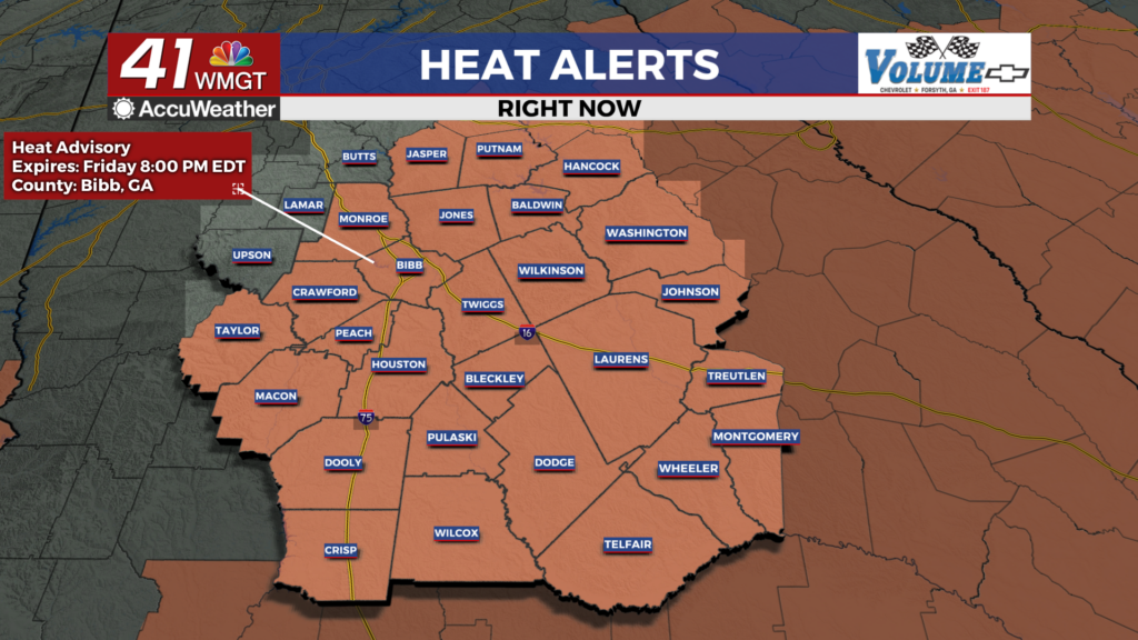


 MACON, Georgia (41NBC/WMGT) – The axis of a trough continues to advance towards Middle Georgia today. An associated cold front pushes into the far northern tier later this morning. The progression of the front will be slow, it’s not expected to reach the I-20 corridor before peak heating hours. Highs are forecast to rise into the low to mid 90s once again. Increasing atmospheric moisture ahead of the frontal system will also nudge dewpoints higher on Friday. As such, heat index values reaching 105 degrees will warrant another Heat Advisory in portions of east-central Georgia (along and south of Cordele to Macon to Washington), which will be in effect from 11 AM until 8 PM. More widespread thunderstorms are expected on Friday afternoon due to a combination of forcing ahead of the cold front and strong destabilization with daytime heating. The combination of conditions could produce several loosely organized storm clusters, which could cause a few severe thunderstorms with winds gusts up to 60 mph. While the severe thunderstorm threat will be largely be in the afternoon and evening, scattered showers and thunderstorms will continue ahead of the cold front overnight as the front continues to move southward through the area. Some very much welcomed relief this weekend as the cold front settles somewhere over Middle Georgia Saturday. High temperatures will likely struggle to get much higher than 80 north of the front. Areas south of the front will see temps up into the mid 80s. Lows will be moderated slightly by moist conditions and widespread precipitation chances, however we could still see the first 60s in a while.