Dangerous heat to start off the new week
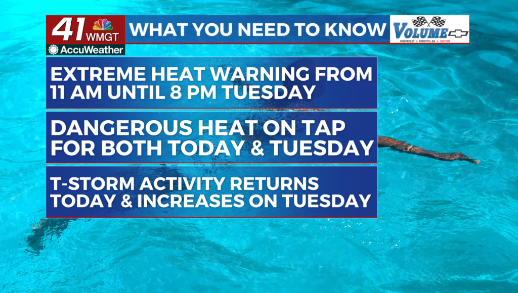
MACON, Georgia (41NBC/WMGT) – Oppressive heat and humidity driven by an upper level ridge over the Southeast, and surface dewpoints in the 70s continues through the next 48 hours. Peak 


 afternoon heat indices in the 103 to 112 range are expected today and Tuesday, with the highest values focused over east Middle Georgia. Diurnally driven showers and storms should return to Georgia today and Tuesday. For today weak subsidence from the upper level ridge should be countered by a shortwave diving south from Tennessee. This may favor convection over north Georgia early in the afternoon. The shortwave may interact with a weak trough over the Carolina coast and South Georgia to produce a few isolated storms in Middle Georgia this evening. Overall storm chances today are generally around 10 to 20 percent for any given location. Severe weather is unlikely, but a couple of storms could produce isolated downburst winds near 40 mph. Thunderstorm coverage should be more widespread Tuesday afternoon and evening, with the increase in activity driven by the trough in southern Georgia and the continued weakening of the upper level ridge. Storm chances should peak at around 60% Tuesday afternoon for north and Central Georgia.