More clouds will lead to a drop in temperatures Wednesday
MACON, Georgia (41NBC/WMGT) – A low pressure system in the area will lead to more clouds and rain for Wednesday, dropping temperatures around Middle Georgia.
This Evening


Cloud cover is increasing around Middle Georgia and more storms are likely through the evening hours. The entirety of the region is included in a Level 1 “Marginal” risk for severe storms, mainly because a few storms could have a couple of damaging wind gusts. The rain will be helpful, however, as many spots are dealing with heat indexes over 100 degrees.


Overnight will be mostly cloudy and rain will likely linger past midnight. Wind will be light from the north-northeast. Lows will be in the low to mid 70s with the possibility for some fog ahead of sunrise Wednesday.
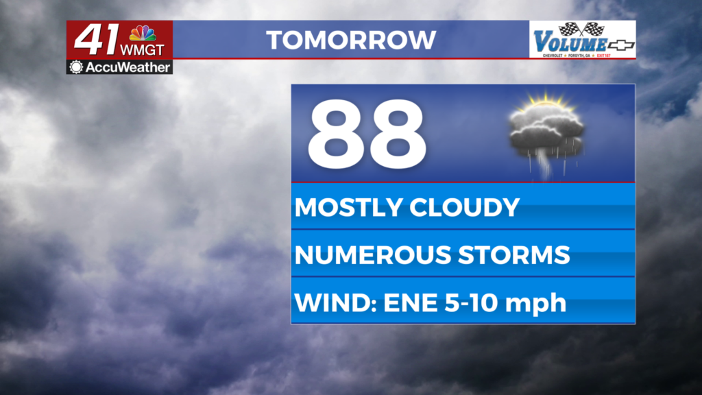
Tomorrow


A mostly cloudy day is expected Wednesday and several rounds of rain are likely throughout the day. Highs will reach the upper 80s and lower 90s with heat indexes into the mid to upper 90s, or 5-10 degrees cooler than what most saw Tuesday afternoon. No severe weather is expected however the most organized storms could bring a few strong wind gusts. Wind will flow from the east-northeast at 5-10 mph.


Overnight will stay cloudy with some showers still possibly lingering after midnight. Expect light wind from the east to accompany lows in the lower 70s. Some fog could again be possible before sunrise Thursday morning.
Thursday and Beyond


A new slow warmup will begin Thursday however plenty of clouds will still hang around. Expect rain odds to taper off a bit each day to finish the work week as temperatures work to climb back into the mid 90s by Saturday. Another heat wave looks possible over the back half of the weekend and into next week.
Watching the Tropics

The area of interest in the Atlantic Basin is no longer expected to develop. There are no other areas to watch in the area at this time.

Follow Chief Meteorologist Aaron Lowery on Facebook (Aaron Lowery 41NBC) and Twitter (@ALowWX) for weather updates throughout the day. Also, you can watch his forecasts Monday through Friday on 41NBC News at 4, 5, 5:30, 6, and 11 p.m.