


Heat ramps up into the weekend
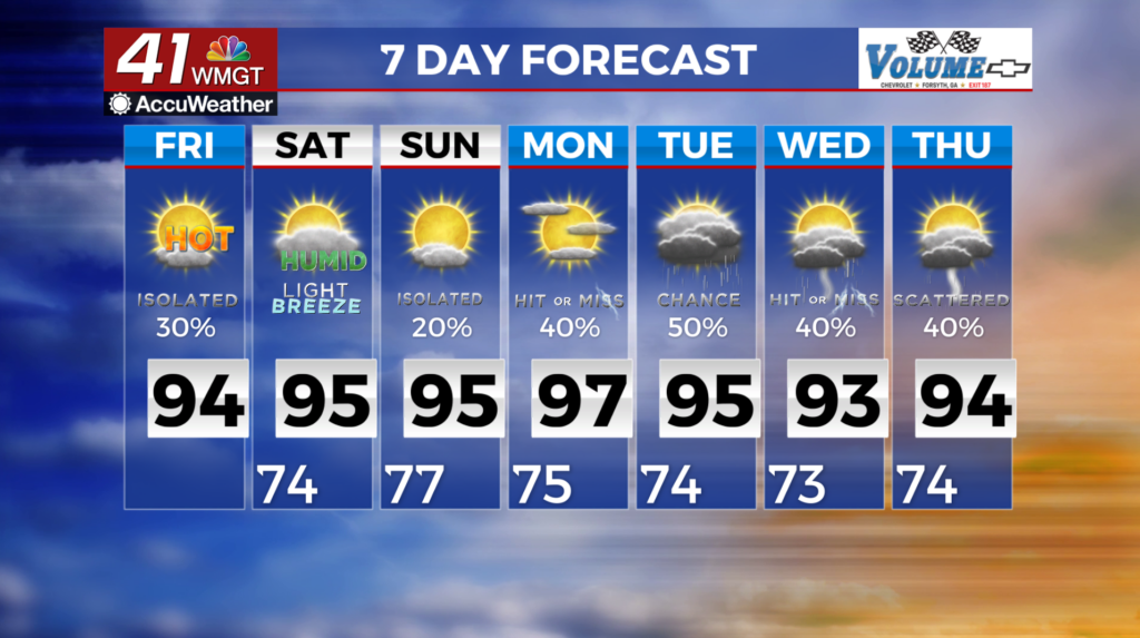
MACON, Georgia (41NBC/WMGT) – Trapped moisture under a building subtropical ridge continues to produce isolated to scattered thunderstorms through the forecast period. No widespread 

 or organized severe weather is expected at this time, however, any strong storms could be capable of producing gusty winds, locally heavy rainfall and frequent lightning. The strengthening high pressure will heat up temperatures into the weekend. Temperatures are likely to reach an apex over the weekend into early next week with highs reaching the mid to upper 90s areawide. Feel like temperatures will exceed 100 for most locations each afternoon with 105-110 more likely across east Central Georgia. Chances for rainfall will remain relatively lower through the weekend with only isolated to widely scattered diurnal convection possible each afternoon/evening. Shower and thunderstorm chances begin to trend upward by Monday courtesy of an approaching backdoor cold front.