Thunderstorms and showers start the new week
MACON, Georgia (41NBC/WMGT) – Our rinse and repeat weather pattern continues for Monday. With lingering troughiness and weak flow, expect the summertime diurnally-driven convection 
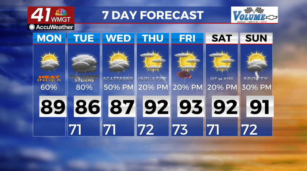
 to continue this afternoon and evening. The Storm Prediction Center has outlooked much of North and Middle Georgia within a Marginal (Level 1 out of 5) Risk for Excessive Rainfall, and any thunderstorms that form may be capable of producing more than just nuisance flooding/ponding of roads and poor drainage areas. We cannot rule out a few potent storms that may pack a punch, but we are not expecting widespread or organized severe weather. Patchy fog with decreased visibility is possible in the wake of Sunday’s precipitation. This could impact the morning commute. Forecast high temperatures will climb into the upper 80s to low 90s this afternoon. Forecast morning lows remain mild with values in the 60s to lower 70s.