Dry weather and above average temperatures are the order of the day
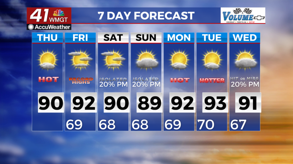
MACON, Georgia (41NBC/WMGT) – A high pressure ridge will be the dominate player in Middle Georgia’s weather today. It’s influence will carry over into Friday as well. We do not expect thunderstorms in northern or Middle Georgia through Friday evening. Temperatures will peak into the upper 80s and lower 90s. There is a chance of our area tying or breaking a daily 
 record high on Friday afternoon. The current record for the date is 91 degrees set in 1962. The factor most likely to prevent a record high would be cloud cover from storms to the west. Afternoon highs will still be 7 to 14 degrees above average all across North and Central Georgia. Our sensible weather through the weekend and into next week will be governed by a group of shortwaves and a frontal boundary trekking southeastward across the region. By early Saturday, a closed low will nudge east across the Great lakes towards New England. As it does, a sector of enhanced flow circulating around the trough will cause instability. This will cause multiple waves of thunderstorms. The timeline for these storms is Friday evening through Monday. Our primary concern for any strong storms that do form will be the potential for isolated damaging wind gusts embedded within the strongest segments of the line.