
Cooler and drier days continue before rain and storms return by Wednesday
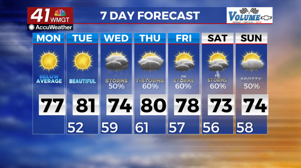
MACON, Georgia (41NBC/WMGT) – High pressure is anchored over the Southeast U.S. as we are expecting dry conditions to prevail on Tuesday. Temperatures Tuesday morning will range 
 from the mid 40s to mid 50s and climb into the 70s to low 80s by the afternoon. As we head towards Wednesday, latest models indicate an upper low to lift to the northeast and a ridge over the Central U.S. to flatten as another trough takes residence over the western two-thirds of the region. West to southwest flow will usher in several weak disturbances across the Southeast through the end of the week. Unsettled weather in the way of showers and thunderstorms return between Wednesday and Friday, perhaps into the early part of the weekend. At this time, rain and thunder chances look to be highest during the afternoon into the evening. Temperatures during this period will remain cooler due to cloud cover with forecast numbers in the 70s in most locations. For northeast Georgia temperatures may only reach the 60s.