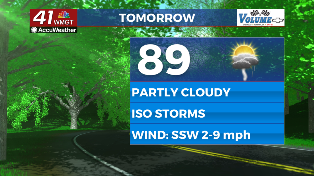
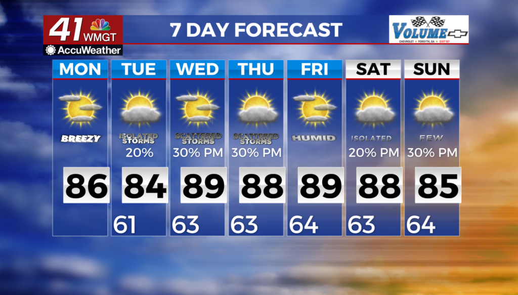
Isolated chances for showers & t-storms Monday afternoon & evening
MACON, Georgia (41NBC/WMGT) – Our streak of days with above normal temperatures continues. A surface cold front will push eastward. This front transverses the ArkLaTex
 overnight, reaching the Lower Mississippi Valley by Monday morning. Scattered to numerous showers and thunderstorms will be ongoing along and ahead of the cold front to our northwest across the Tennessee Valley Monday morning. The cold front will then become stationary to the northwest of the coverage area by Monday afternoon, though sufficient moisture and instability in advance of the front will lead to increased chances for precipitation in the northwest and far northern Georgia. At this time there is no severe threat, however, locally gusty winds, lightning, and brief heavy rainfall could be possible. Scattered showers and a couple of thunderstorms will remain possible Monday night, mainly north of I-85. Both daytime and overnight temperatures remain above normal through the forecast period.