Warmer temperatures for Easter, rain chances for the new week
MACON, Georgia (41NBC/WMGT) – The 80s aren’t just back in style again, they’re also coming back for our highs this weekend and onward. A building upper level ridge and increasing southerly 
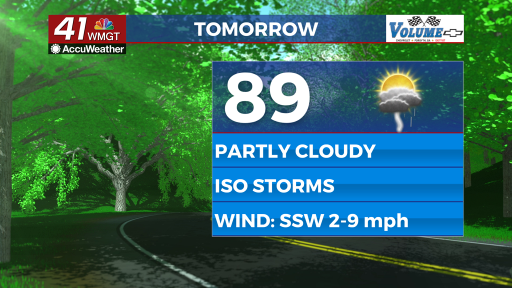
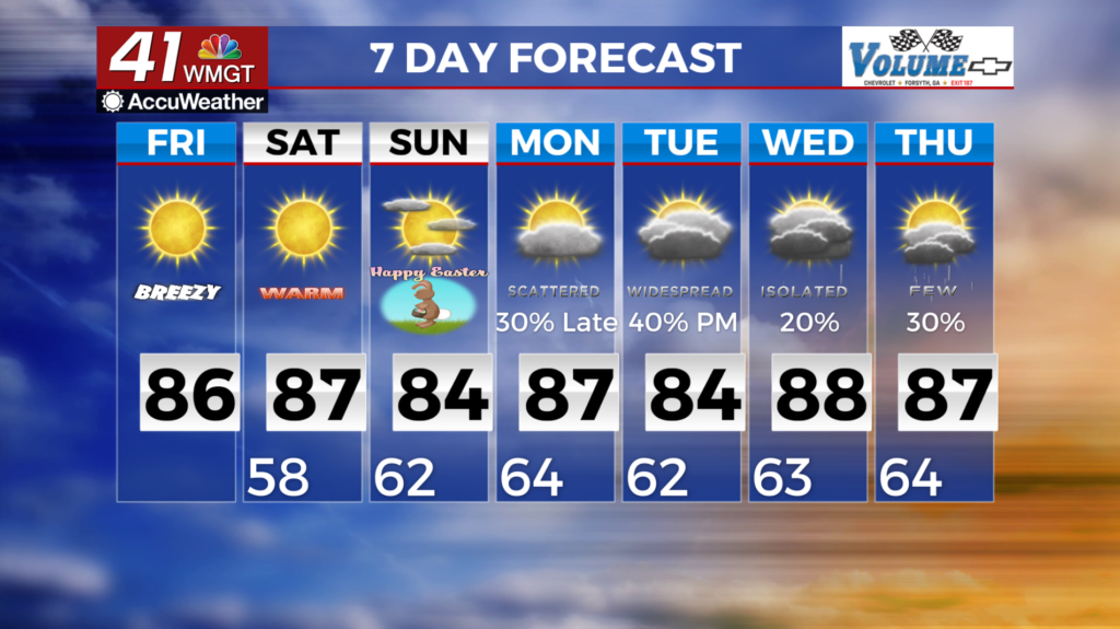
 flow will mean highs peak on Saturday in the mid to upper 80s and likely remain above 80 through next week. Lows will be in the 50s and 60s. We are not likely to see much in the way of rainfall through the long term. The greatest chance for any rain/thunderstorms will come with a stalling cold front sometime on Monday. Current models indicate the arrival time at Monday morning, depending on the stalling and uncertainty in how much the mid/upper level ridge breaks down, the front may move slower than anticipated. At this time no severe weather is expected. A modest chance for showers and thunderstorms remains through the rest of the week. Daytime heating will relegate formation mostly to the afternoon hours and any forcing will be best along the stalled front.