
Pleasant days ahead as temperatures stay warm
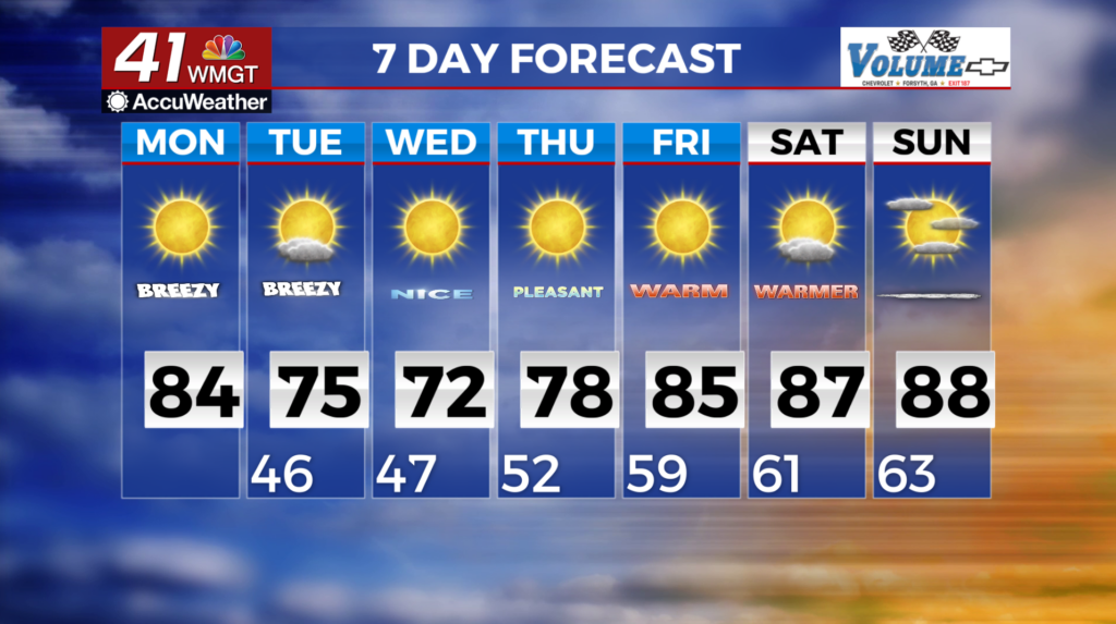
MACON, Georgia (41NBC/WMGT) – High pressure remains draped across the Florida peninsula. A weak front will begin to approach the area late tomorrow night, bringing a slight chance of 
 showers for far northern portions of the state. Winds turn northwesterly Tuesday as the upper level low pushes eastward. The positioning of the low will determine how much rainfall we receive with this frontal passage. The latest model have the low pressure well north of the area resulting in precipitation chances confined to north Georgia at this time. Gusty northwest winds will continue following the front into Tuesday and Wednesday as high pressure pushes in again towards the middle and later part of the week. Winds are expected to be gustier than normal at 25-30 mph with locally higher gusts in higher terrain. As temperatures begin to rise into the later half of the week into the low to mid 80s we will see a very similar set up to Tuesday’s frontal passage setting up again. High pressure to our south and east and then troughing to the west. Current models are still trending drier on this system. Overall a pleasant forecast over the next 7 to 8 days!