


Weekend starts hot, ends cold
MACON, Georgia (41NBC/WMGT) – An upper level ridge remains in place as overnight moisture return allows for the potential for low level cloud cover similar to yesterday. In the long 

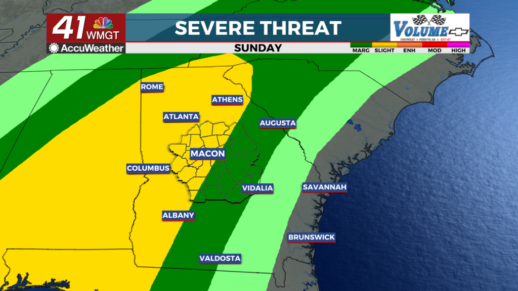
 term, we’re looking to break high temperature records. Highs could easily push 90 degrees in some places on Saturday and even into Sunday. But the gamechanger will be Sunday as a cold front pushes through sometime Sunday afternoon. With temps in the upper 80s, over mid 60s dewpoints it makes sense that we’re set up for some convective activity. Timing will make all the difference in how big a threat this next front will be. Some models have it pushing through later in the afternoon which will allow for more instability to build. The main area of concern will be along the Georgia/Alabama border south of I-20. Believe it or not, after the front pushes through we’ll likely see some widespread frost and freezing in the area Wednesday and again on Thursday morning as reinforcing cold air is pushed out of the north. Temperatures are expected to drop below freezing north of I-85. High temps will be in the 60s for most of the workweek and will gradually push back into the low 70s by the time next weekend rolls around.