


Spring today; Summer-like by midweek
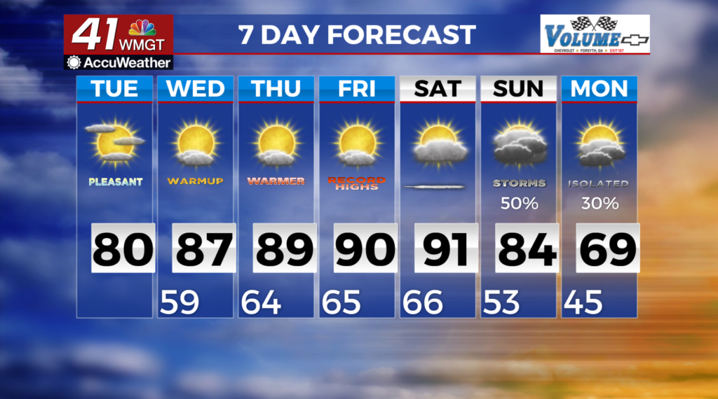
MACON, Georgia (41NBC/WMGT) – The strong line of storms that brought damaging winds, hail, and a brief spin up tornado has moved out of the area. The front ushered in cooler and  drier airmass overnight. Surface high pressure is building in behind the front today and will support dry conditions with light winds, mostly sunny skies, and high temperatures climbing into the mid to upper 70s to low 80s. Looking ahead, our area will be influenced by a persistent Bermuda High that will set up shop across the eastern Gulf to the Carolina coast. As a result, expect southwesterly flow and warm air to develop. There is an isolated chance for a shower to develop due to mid-level flow causing shortwave development. Also, there will be unseasonably warm high temperatures under this unusually strong high pressure ridge. Starting Wednesday, highs will be in the mid 80s. Temperatures will continue to warm by a degree or two until Saturday, when we peak into the upper 80s to lower 90s! We could tie or set a new record high!