Severe weather starts the beginning of the new week
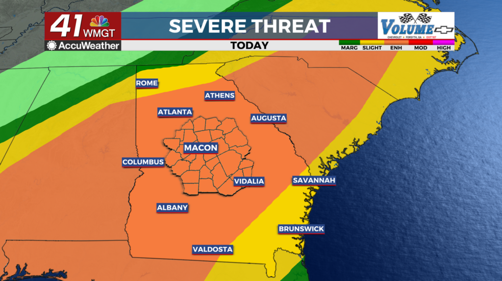
MACON, Georgia (41NBC/WMGT) – A strong surface cold front extending from another low near Chicago to north Texas will push across the area today, exiting the area by Monday evening. A 

 deep layer of moisture continues to increase across the region today. Expect cloud cover to remain however, some models are indicating a few strong to borderline severe storms are possible in areas that receive sun. Storms have arrived in some areas already ahead of the cold front. As a result, the greatest threat of strong to severe storms is expected to hold off until Monday morning and ahead of the actual front. As a result, the Storm Prediction Center has an enhanced risk of severe storms across the area for today. The greatest threat will be from gusty, straight line winds, but a few storms may produce tornadoes or hail. Temperatures will be warm during this short period, highs on Monday ranging from the upper 70s to the lower 80s. Cooler air will filter in behind the cold front Monday night, with lows ranging from the lower to mid 40s across the north to the near 60s in the southeast.