Showers late, then all eyes on the weekend for possible severe threat
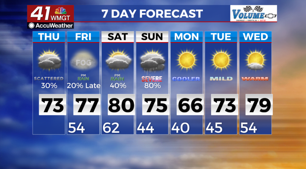
MACON, Georgia (41NBC/WMGT) – For Thursday the primary concern will be the potential for garden variety showers and thunderstorms. The greatest coverage is anticipated during the afternoon and evening as showers move east out of Alabama. Instability and wind shear will be marginal, though some severe risk will be east for counties closer to the Georgia/Alabama border. The Storm Prediction Center has issued a marginal risk for west central Georgia. The best potential for damaging winds and hail should be with the first line of storms in the afternoon. Any rainfall should diminish quickly and most of east Georgia will remain dry during this event. Over the long term, the concern still remains the weekend severe potential. For this event strong dynamics are in play. The first wave will bring elevated convection. The second wave will bring the entire system eastward. The timeframe is still Saturday evening into Sunday morning. Start making your severe weather plans now. Know where your safe place is, make sure your weather radio is working. Remain weather aware. Be prepared not scared.