Dry and warm as showers arrive on Thursday
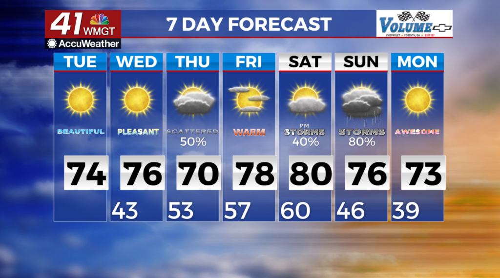
MACON, Georgia (41NBC/WMGT) – We have a dry and very warm day ahead, with early morning temperatures in the upper 30s to low 40s rapidly rising into the low to mid 70s by mid-day.  High fire danger could develop in north and Middle Georgia Wednesday. The main fire weather forecast challenge for this period involves how fast dewpoints recover with the southerly flow on Wednesday afternoon. Relative humidity values are projected to be in the 25% range focused over the North Georgia mountains. A weak trough moves towards our area. Models are favoring this event to be a weak one. While chances for rainfall remain fairly high (50%-70%) significant rainfall is not anticipated. Daytime heating could lead to a couple rumbles of thunder Thursday afternoon, however, a widespread severe event risk is not anticipated. After a transitional day on Friday, this weekend will be the next opportunity for impactful weather. The set up for Saturday into Sunday currently includes the potential for both severe weather and flooding. In addition, a strong trough over the Great Lakes and a secondary shortwave lifting north from the Gulf could also have effects. The second wave is key to our region, and at this time track and timing are uncertain. Currently, late Saturday severe weather and or flooding are most probable in Northwest Georgia given current models.