A final push of showers leads to pleasant weather by midweek
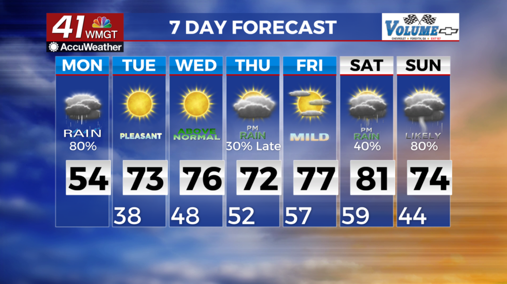
MACON, Georgia (41NBC/WMGT) – A final push of showers and/or thunderstorms will move through Monday morning. This activity will be on and off for the most part. A strong upper level system will swing across the Mid-South and the surface low will hug the Gulf coastline passing to our south. Forecast lows will be cooler with values in the low to mid 40s. Wrap around moisture from the upper level system will keep clouds and some showers around for parts of North and Middle Georgia during the morning. Though rain will gradually depart from the west to east and skies will clear through the late afternoon, some areas will still have cloudy skies. Forecast high temperatures will range from the mid 60s in northwest Georgia to mid 50s elsewhere. Expect mild and dry conditions through mid-week as a sub-tropical mid-level ridge and surface high pressure build over the area in the wake of the system from Monday. High temperatures will be above normal, climbing into the mid to upper 70s by Wednesday, with lows in the low to mid 40s.