
Cooler temperatures for the weekend
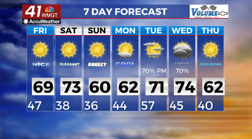
MACON, Georgia (41NBC/WMGT) – Surface high pressure builds across the region today, bringing clear skies and temperate conditions. High temperatures will warm some 5 to 8 degrees above normal. As has been the case the last few days, fire weather will be the chief forecast concern today. Dew points are low and as a result a Fire Danger Statement has been issued by the National Weather Service given the very dry conditions. Saturday will bring the approach of a dry cold front which will sweep across the area during the afternoon. The result will be increasingly gusty west to northwest winds through the afternoon and a reinforced dry airmass.
 Amid the increased northwest winds, dry air mass, and ongoing dry fuels, Red Flag Conditions can’t be ruled out on Saturday. Wind gusts could get as high as 25 to 30 mph in portions of North and Middle Georgia in addition for dewpoints to be low due to the airmass being so dry. Low temperatures for Saturday overnight into Sunday morning will be in the mid 30s to low 40s. High pressure settles into the southeast on Sunday and Monday.