Stingy showers increase fire danger
MACON, Georgia (41NBC/WMGT)- Isolated to scattered showers ahead of a front will enter far Northwest Georgia in the morning, advancing south and east over the course of the day, as a parent low pulls away to the northeast. With only meager moisture return in the southwesterly low flow, there will be very little to no moisture near the front.
R ainfall amounts associated with this system are expected to total less than 0.1 inch, which won’t do much for the continually drying fuels.
Thunderstorms are not expected, as dynamics associated with the front will be weakening as the surface low moves into the Northeast and instability will be very weak.
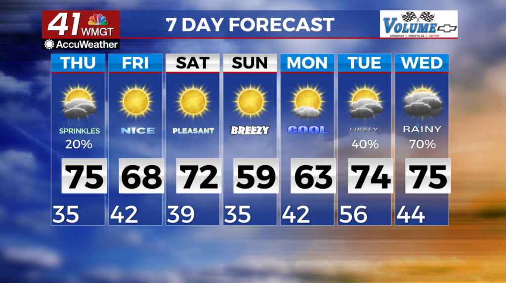
High temperatures on Thursday will range from the low to mid 60s across North Georgia to the upper 70s in east-Middle Georgia. Minimum relative humidity values on Thursday will be above the critical fire danger levels ranging from 35 to 45 percent. Northwesterly winds will return on the backside of the front as it clears the area Thursday night, which will bring about a return to cooler and drier weather for early Friday morning.