
A wet Wednesday leads to a much colder Thursday
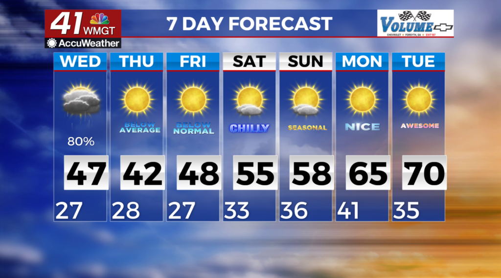
MACON, GEORGIA (41NBC/WMGT)- Widespread light precipitation will begin to overspread the area
from the south and west Wednesday morning. Models continue to indicate the potential for wintry weather
across portions of north Georgia. The main types would be snow and rain. Higher elevations will have the
best chance for accumulating snow. Other areas south could likely see a rain/snow mix at times. Further
south, all rain is anticipated as the system moves through tonight and early Thursday.
Much colder air will move in, with highs on Thursday in the 30s across much of north Georgia, with the
mountains not getting out of the 20s! Friday morning will bring lows in the lower teens to mid 20s.
Wind chill values on Thursday morning and Friday morning will be in the single digits above zero to the
teens across most of the area.
Temperatures will rebound over the weekend into next week and will remain dry.