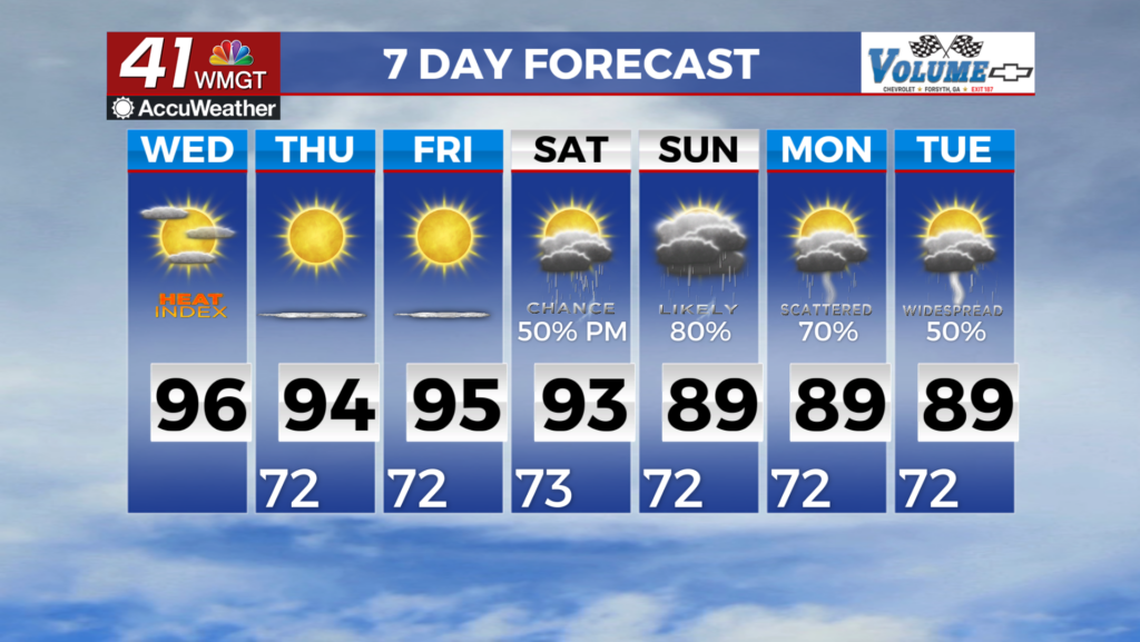

Quiet weather sticks around this week
After a chilly start today we managed to warm back into the 70’s thanks to plenty of sunshine. Expect more of the same as we head into Wednesday.
Clear skies overnight will allow our low temps to drop into the 40’s, but just like today, we will quickly warm back to the 70’s through the afternoon.
The rest of the week will bring a slight warm up to the area. A center of high pressure will pass to our east and bring easterly winds to Middle Georgia.
This means increased humidity and warmer temps can be expected for our area through the end of the week.
By Saturday we will start to see a chance of showers developing and maybe even a thunderstorm. We will also start to see more tropical humidity.
The chance of showers and storms will stick around for the rest of the weekend and into next week.
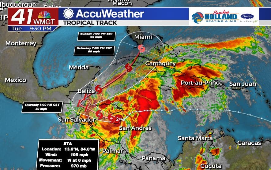
Believe it or not, part of the reason we will see increased shower chances is Hurricane Eta. Eta made landfall as a Category 4 Hurricane in Nicaragua this afternoon, bringing deadly storm surge, flooding, and landslides, not to mention 140 mph winds.
Eta will continue to work its way through parts of Central America through the week before it moves back into the Caribbean. Based on some of the latest weather models, Eta will likely regain tropical storm strength and move towards south Florida.
We still don’t know the impacts for Middle Georgia, but it is still hurricane season so we will be watching it closely.
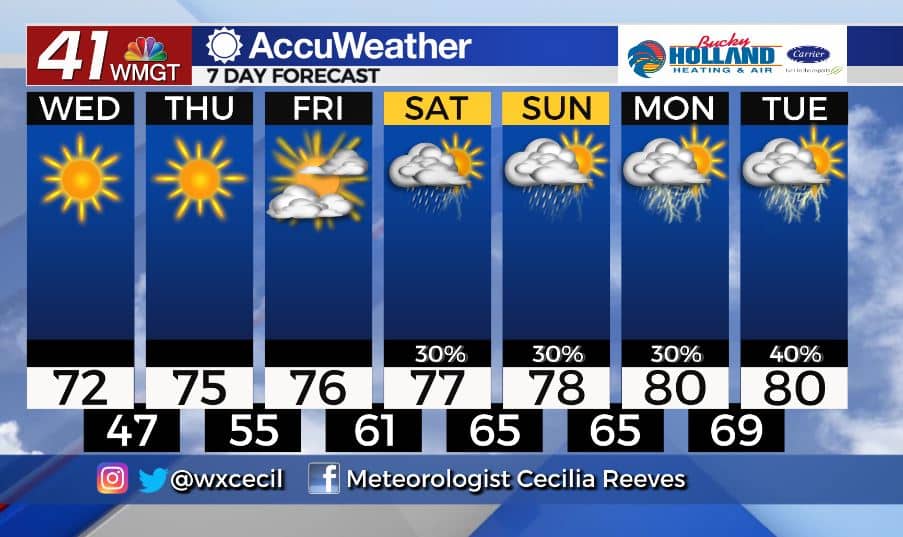
That being said, next week the forecast is based on some impacts from Eta such as increasing tropical moisture and a chance of showers and storms for the start of next week.


Leave a Reply