
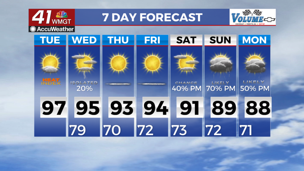

Warm weather on the way this weekend
We get a one day break from rain chances on Saturday behind the cold front that moved through earlier.
Saturday will be a warm and mostly sunny day in Middle Georgia with highs in the mid 80’s. With the increased humidity, it will feel like the upper 80’s and even low 90’s.
Sunday will bring another chance of showers and thunderstorms to the area. This will not bring a widespread cool down, but will bring a few areas of heavy rain.
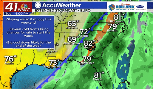
To start the week, we will continue to see a chance for showers and storms ahead of a cold front that will eventually move through sometime Tuesday.
A few models are hinting that we could see a few strong storms on Tuesday, but it is still pretty far out. We will just have to watch and wait.
Regardless of the rain and storms, a cool down will follow the front as well as much drier air. Hooray for another taste of fall!
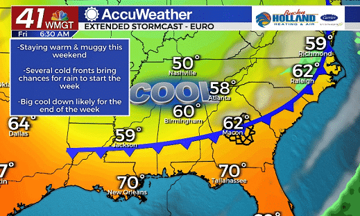
By the end of the week we are expecting another cold front (this one will be dry) that will bring a reinforcing shot of cold, dry air. This one is where we will see the lows drop to the low 50’s and highs will be limited to the lower 70’s.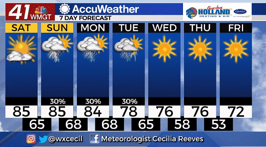
In general the start to the week might be a bit rainy and stormy, but by the end of the week we will be able to break out the sweaters and pumpkin spice lattes again!
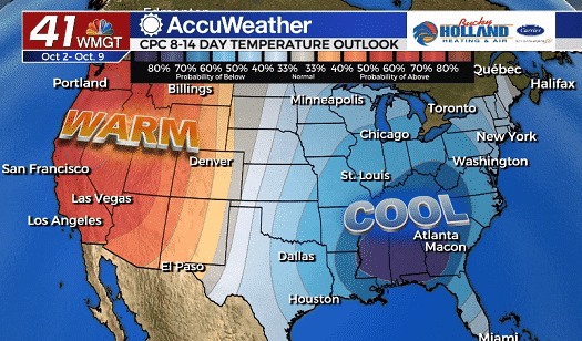
Even beyond the next 7 days, cooler than normal high temperatures are forecast for much of the southeast. Considering how hot it was last fall, I will take the cool weather a little early this year.

Leave a Reply