
Low pressure brings scattered storms to Middle Georgia this week
Rain cleared out of Middle Georgia through the day and we ended up with a pretty nice Monday.
As we head into the rest of the week all eyes are on a large area of low pressure that is currently to our north. This area of low pressure will meander down into our area and create a general storminess through the rest of the week.
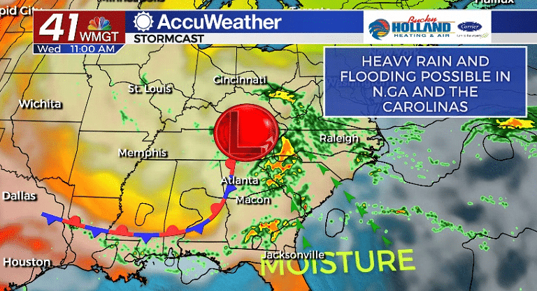
Not only will this bring pop up showers and storms to Middle Georgia, but it will also increase moisture and bring heavy rain to our north.
Areas of North Georgia all the way into central North Carolina will see very heavy rain with the potential for significant flooding in North Carolina.
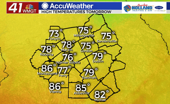
Not only will we be seeing a few showers and storms tomorrow, but we will also see a wedge front setting up. This wedge front will keep our highs a good bit cooler than normal. Highs south of Eastman will be much warmer outside of the wedge.
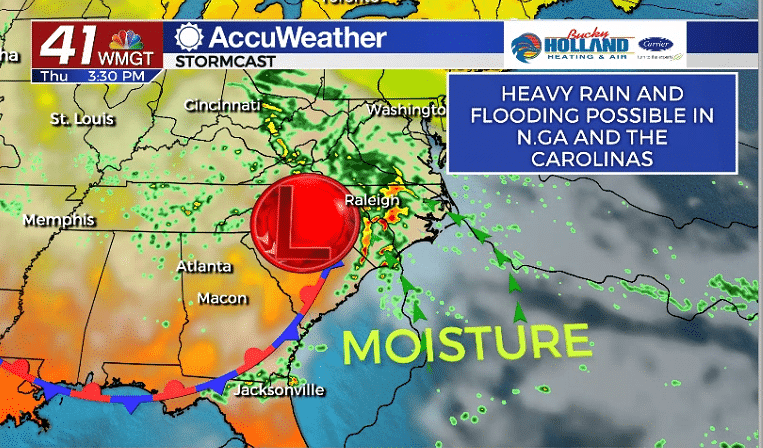
The wedge front will move out pretty quickly as the low pressure pushes off to the east, but we will continue to see isolated showers through the rest of the week.
Temps on Thursday start warming a bit with much of the area back in the 80’s.
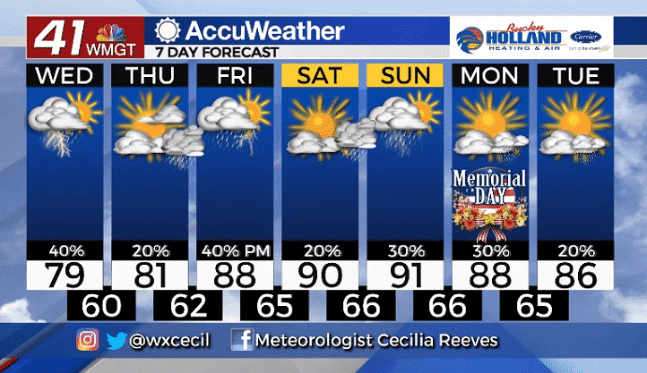
The end of the week will bring a big warm up with highs returning to the 90’s. Scattered storms will hang around through the weekend and into Memorial day.
There are still some questions about the storms over the weekend, but regardless it looks like it will be a warm one.

Leave a Reply