Triple digits expected again Wednesday
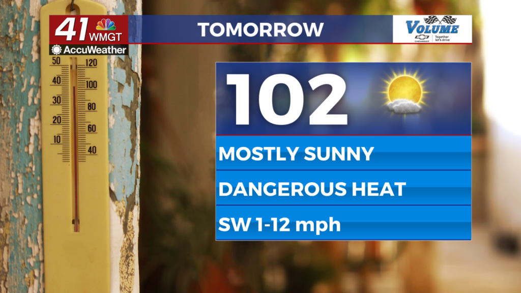
MACON, Georgia (41NBC/WMGT) – High temperatures around Middle Georgia will again reach the triple digits in many spots Wednesday.
This Evening


Skies will stay sunny around Middle Georgia while temperatures stay in the upper 90s for most of the evening. Overnight skies will remain mostly clear as temperatures drop into the lower 70s and upper 60s, around average for this time of year. Ambient winds will be light and variable, eventually resolving out of the southwest by sunrise tomorrow.
Tomorrow


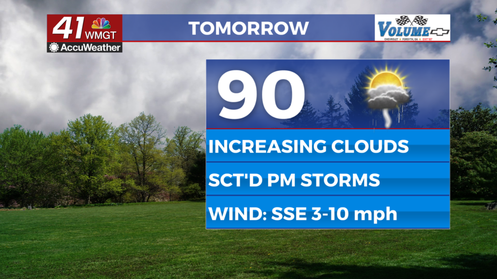
Another scorcher is on deck for Middle Georgia as close to half the region should see highs that eclipse 100 degrees. Wind will be light out of the southwest as skies remain mostly sunny. An isolated shower or storm will be possible late in the afternoon/evening with the best odds for that being in the southeastern counties. UV Index values will likely be in the extreme range again, so sunscreen is a must for anyone working in the high heat.


Tomorrow night things will be a bit muggier thanks to wind flow remaining out of the southwest. Lows will be in the lower 70s under partly cloudy skies.
Thursday and Beyond


High temperatures should largely stay below the 100 degree threshold starting Thursday, but real feels will arguably be higher as the humidity upticks with isolated storms in the afternoon and evening. Heat indexes to finish the week and over the weekend will likely be north of that 100 degree mark even if the actual temperatures are not. This pattern will carry into the start of July.

Follow Meteorologist Aaron Lowery on Facebook (Aaron Lowery 41NBC) and Twitter (@ALowWX) for weather updates throughout the day. Also, you can watch his forecasts Monday through Friday on 41NBC News at 4, 5, 5:30, 6, and 11 p.m.