

Warming up Friday in Middle Georgia
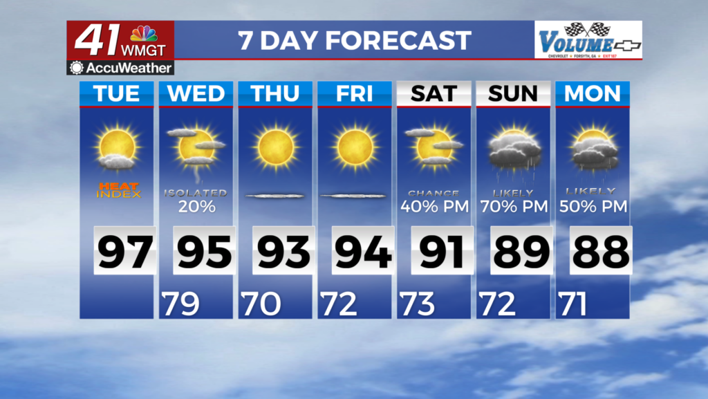
We started Thursday chilly across Middle Georgia, with lows dropping to the upper 30’s in Macon this morning. We will finally get a warm up from these chilly mornings by Friday.
Through the day on Friday high pressure, that has kept us clear and cool the past few days, will push off to the east. This will allow our highs to warm back into the upper 70’s and low 80’s.
Scattered showers and partly to mostly cloudy skies will move in for Saturday. This is ahead of our next chance of severe storms.
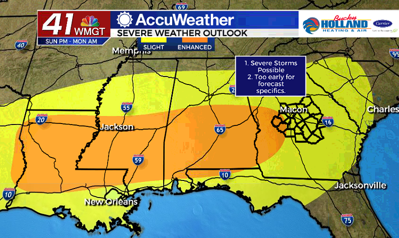
The Storm Prediction Center has already issued an enhanced chance of strong to severe storms for Sunday night into Monday morning.
Yes, this is very similar to what we saw this past weekend, but it does look like this will be a less potent system. That being said it should still be taken seriously.

We are anticipating a few showers and storms ahead of a front that is forecast to push through early Monday morning.
Based on the models right now, the main threats will be damaging winds, isolated tornadoes, as well as heavy rain.
This will likely be gone by Monday afternoon, but another severe threat will be possible by Thursday.
As always we will be here with the latest on the threats and updated forecasts.

Leave a Reply