
Severe Storms, heavy rain possible Tuesday
Well, as expected rain is back across Middle Georgia tonight, although heavy rain has mostly stayed to the north, there is plenty of rain left for the rest of the week.
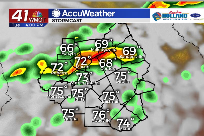
A warm front is working its way across the southeast this evening and bringing with it some strong storms to parts of Missouri and Kentucky. Along with the chance of storms we will see a big warm up into the 70’s and an increase in humidity.
A line of storms will push through tomorrow afternoon along a cold front. Some of these storms could be strong to severe.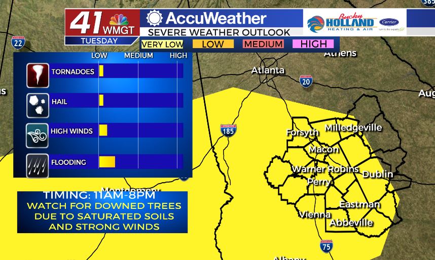
Strong storms could begin as early as 11 am, but I expect most of the severe threat to come in the afternoon/early evening. Main threats will likely be strong winds, heavy rain, and isolated tornadoes.
We also need to monitor the possibility of downed trees from saturated soils. Be sure to have a way to get your warnings.
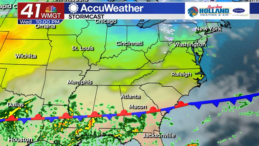
Behind the front we will get about half a day of dry conditions. Then a stationary front will push north bringing back rain chances by Wednesday evening. This will begin another round of heavy rain.
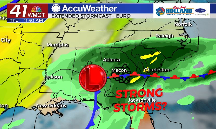
We will finally see an end to the rain, but not before another chance of strong storms by Thursday. Right now the best chance for severe storms will be to our south. Behind the front we will finally see clearing and then much colder air moves in by Friday.
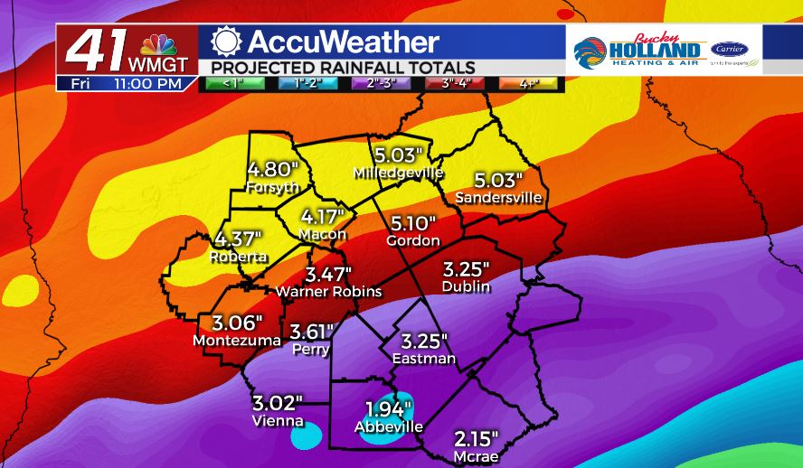
While we are concerned about a few chances for severe storms, the main concern will be flooding rains. It is not out of the question that we could pick up 3-6″ of rain between now and Thursday night.
River flooding and localized flooding will both be possible through the end of the week.

Leave a Reply