
Warming trend begins in Middle Georgia, ahead of Saturday storms
Hope you enjoyed the day of full sunshine in Middle Georgia, because clouds are back in the forecast ahead of rain and storms by the weekend.
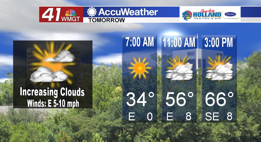
High pressure begins to move out of Middle Georgia tomorrow, which will give way to more clouds and more moisture in the area. Winds from the east will pick up through the afternoon, but won’t get to a gusty level.
By Friday, a line of severe storms associated with a cold front begin to push into Texas and Louisiana. This will bring the treat of severe storms to that area including tornadoes and damaging wind gusts.
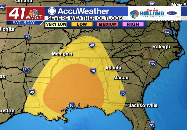
By Saturday that threat will shift to Mississippi, Alabama, and Georgia. Right now the forecast looks more confident that we will see strong storms in MS and AL, but here in Middle Georgia a lot depends on the timing.

Our current forecast brings these storms in across Middle Georgia at some point during the afternoon and evening on Saturday. A lot will depend on what happens ahead of the front, but right now it looks like we will be getting the end of the worst of the storms.
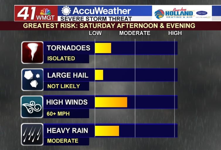
Although we are keeping our fingers crossed that the storms don’t hold together, if they do make it to Middle Georgia with their full strength we can expect isolated tornadoes, damaging winds, and heavy rain.


Leave a Reply