
Few showers today
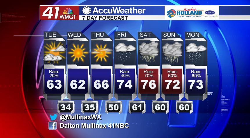
MACON, Georgia. (41NBC/WMGT) – A few showers are to be expected today with a passing cold front as temperatures warm back into the 60’s.
TODAY.
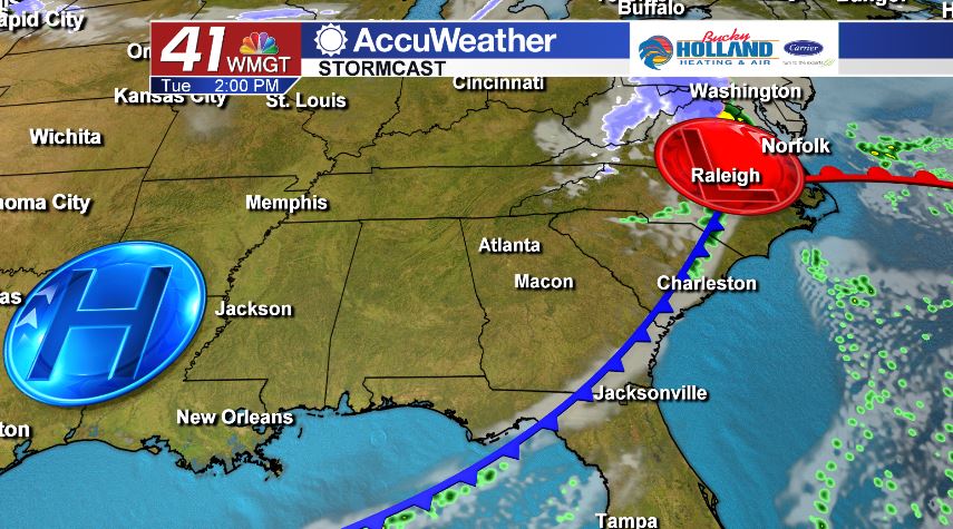
A weak cold front is going to be moving through the area during the first half of the day. While this frontal system is deprived of moisture, we will be able to squeeze out a few showers as the front moves through Middle Georgia. Rain chances today are running at 20%. Once the front clears our area, temperatures this afternoon will be on the rise into the low and middle 60’s under a partly sunny sky. It will be breezy as well with the wind gusting to 20 mph at times. Overnight tonight and into tomorrow morning, clouds will be scarce and temperatures will bottom out in the middle 30’s.
TOMORROW.
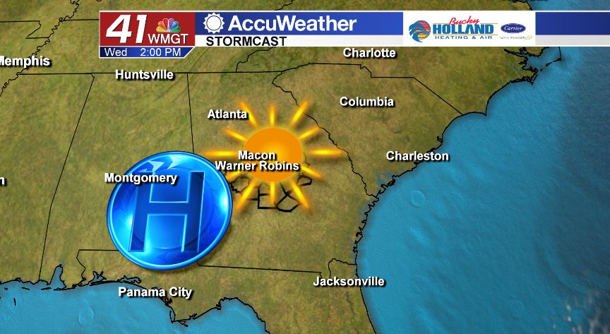
We will be dry on Wednesday as high pressure builds in from the west. You can expect plenty of sunshine and temperatures in the low to middle 60’s once again.
EXTENDED FORECAST.
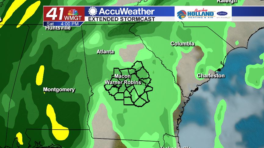
Thursday is mostly dry, but our wet weather pattern sets up as we head into the weekend. Late Thursday and into Friday we will begin to see isolated rain chances across Middle Georgia. That will continue throughout the day on Friday. As for Saturday, there will be a dynamic cold front moving through the area that could bring strong to potentially severe storms to our area. Right now, it is too early for specific timing or potential impacts, so make sure to stay tuned in to 41NBC over the next few days as the forecast becomes more clear.
Follow Meteorologist Dalton Mullinax on Facebook (Dalton Mullinax 41NBC) and Twitter (@MullinaxWX) for weather updates throughout the day. You can also watch his forecasts Monday through Friday on 41NBC News at Daybreak (6-7 a.m.) and 41Today (11 a.m.)


Leave a Reply