


Heavy rain and a few storms move in
MACON, Georgia. (41NBC/WMGT) – A pair of cold fronts will move through between now and Saturday afternoon bringing heavy rain and a few storms to our area.
TODAY.
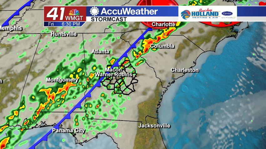
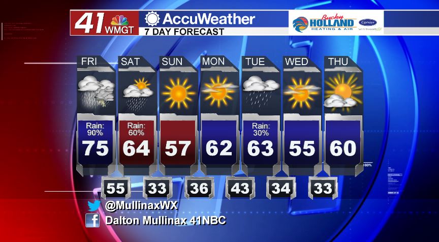
A low pressure system will drag a cold front across Middle Georgia later today and into the nighttime hours. This afternoon, under a mostly cloudy sky, temperatures will be topping out in the low to middle 70’s. It is going to be a warm and muggy afternoon as scattered showers and a few thunderstorms move through. While widespread severe weather is not expected, a few strong storms cannot be ruled out.
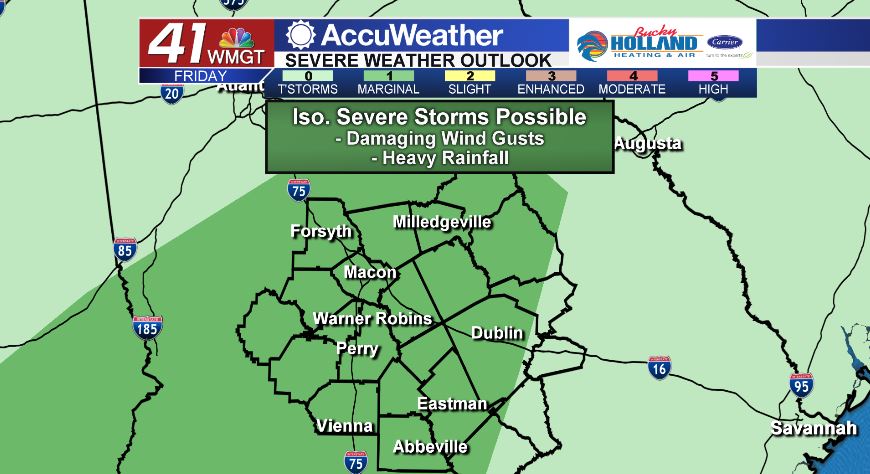
As of 5 am on Friday, January 3, the Storm Prediction Center has placed nearly all of Middle Georgia in a Marginal (level 1/5) risk area. The main storm threats for today will be damaging wind gusts up to forty miles per hour combined with heavy rainfall that could total up to 2″ in isolated areas by the end of the day on Saturday.
Tonight we will keep the scattered showers around as temperatures fall into the middle 50’s.
WEEKEND.
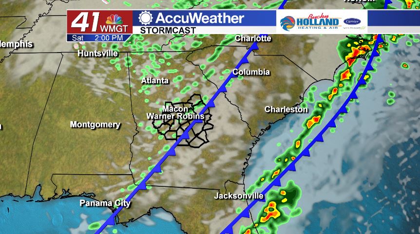
Our second, and weaker, cold front will move through during the afternoon hours on Saturday, and behind this front is drier and cooler air. Before that air mass gets here, we will be dealing with a few isolated showers throughout the day on Saturday. Temperatures will be topping out in the middle 60’s during the afternoon before falling into the low and middle 30’s overnight. Temperatures will be very seasonal (mid 50’s) on Sunday under a sunny sky.
NEXT WEEK.
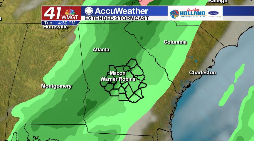
We start the work week off on a dry note before another cold front moves through on Tuesday bringing isolated rain chances.
Follow Meteorologist Dalton Mullinax on Facebook (Dalton Mullinax 41NBC) and Twitter (@MullinaxWX) for weather updates throughout the day. You can also watch his forecasts Monday through Friday on 41NBC News at Daybreak (6-7 a.m.) and 41Today (11 a.m.)

Leave a Reply