

Storms to continue into afternoon
MACON, Georgia. (41NBC/WMGT) – A cold front sweeping across the southeast will keep shower and thunderstorm chances around through the afternoon before we clear off and cool down.
TODAY.
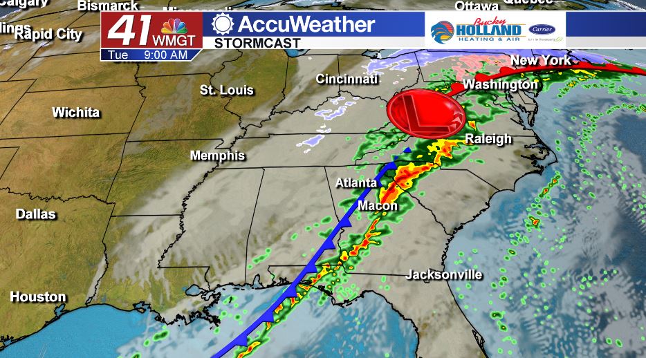
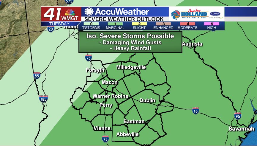
We have started off the morning with scattered showers and a few embedded thunderstorms across Middle Georgia. As we head through the morning and early afternoon hours, our main storm threats will continue to be damaging wind gusts, heavy rainfall, and lightning. While the threat for a brief spin-up tornado is low, the threat is not zero. Make sure you have a way to receive severe weather warnings if they were to be issued.
As of 5 am this morning, the Storm Prediction Center has parts of Middle Georgia in a Marginal (level 1/5) risk area. Again, the main storm threats will be 40 to 60 mile per hour wind gusts and heavy rainfall.
As the front pushes through, temperatures will fall throughout the day. We will spend much of the afternoon and evening in the 50’s. We clear out quickly tonight and we are going to be pretty chilly to start off tomorrow morning. Morning lows are expected to be in the low to middle 30’s.
EXTENDED FORECAST.
We stay dry and cool through the end of the work week. Temperatures will top out in the low and middle 50’s after starting the day off in the upper 20’s and lower 30’s. Cloud cover will be on the rise Friday ahead of isolated rain chances this weekend.
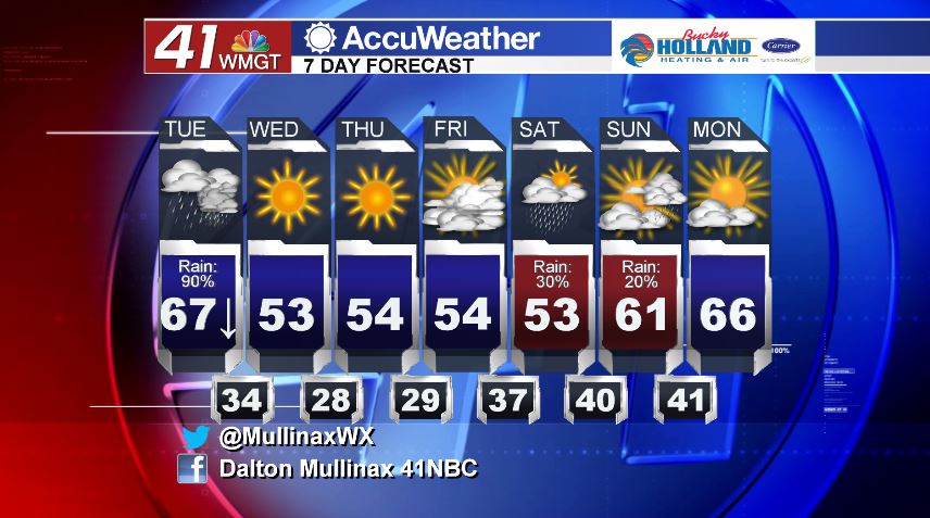
Follow Meteorologist Dalton Mullinax on Facebook (Dalton Mullinax 41NBC) and Twitter (@MullinaxWX) for weather updates throughout the day. You can also watch his forecasts Monday through Friday on 41NBC News at Daybreak (6-7 a.m.) and 41Today (11 a.m.)

Leave a Reply