Showers likely tonight and tomorrow morning
MACON, Georgia (41NBC/WMGT) – An incoming cold front will bring scattered showers to Middle Georgia after midnight tonight and into tomorrow morning.
The Rest of the Evening


Cloud cover around Middle Georgia will ramp up during the suppertime hours. The wind will remain rather breezy from the southwest tonight as sustained speeds range from 10-18 mph with gusts pushing upwards of 30 mph. These winds will lead to much warmer overnight conditions with lows expected to be in the mid to upper 50s. Showers will likely begin to enter the northwestern counties shortly after midnight, continuing south as sunrise Friday approaches.
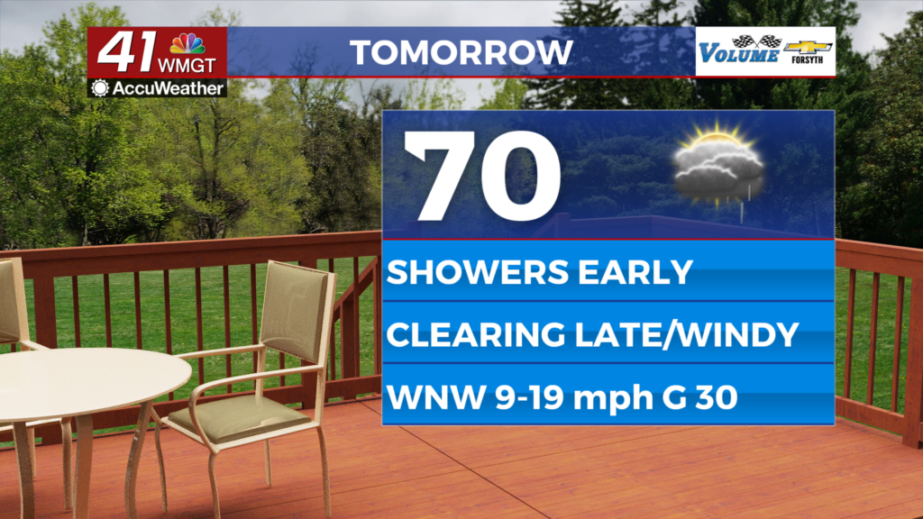
Tomorrow


It will be a somewhat wet start as scattered showers continue through the sunrise hours Friday. These will peter out as the morning goes on, however around lunchtime a second round of small showers will be possible over the southern half of the region.


Later in the afternoon clouds will clear out as the winds shift towards the northwest. Speeds will range from 10-20 mph with gusts likely pushing 30-35 mph in the cold front’s wake. High temperatures will reach the upper 60s and lower 70s.


Overnight skies will be clear with winds remaining rather breezy (10-15 mph) from the northwest. Gusts could still range from 20-30 mph. Temperatures will dip into the upper 30s and lower 40s ahead of Saturday morning.
This Weekend


Saturday will be mostly sunny with powerful winds continuing to come in from the northwest. Highs will likely reach the mid 60s around the region before plummeting to (or below) the freezing point ahead of Sunday.

Sunday will be sunny and calm as high pressure takes over the region. Highs will likely reach the lower 60s for most of the region in the afternoon.

Follow Meteorologist Aaron Lowery on Facebook (Aaron Lowery 41NBC) and Twitter (@ALowWX) for weather updates throughout the day. Also, you can watch his forecasts Monday through Friday on 41NBC News at 4, 5, 5:30, 6, and 11 p.m.