
Drier air on the way through end of work week
MACON, Georgia. (41NBC/WMGT) – Drier air works into area behind cold front passage later today.
TODAY.
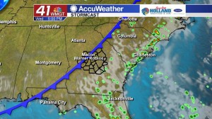
An isolated shower or two cannot be ruled out due to the frontal passage, but I am expecting a mostly dry and sunny afternoon across Middle Georgia. Temperatures will be warming back up as well. The past several days we have seen temperatures in the 80’s, but this afternoon we are going to return to the 90’s area wide. Tonight is going to be a very comfortable night. Temperatures will be cooling off into the middle and upper 60’s under a mostly clear sky.
EXTENDED FORECAST.
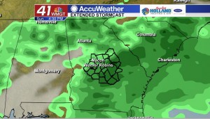
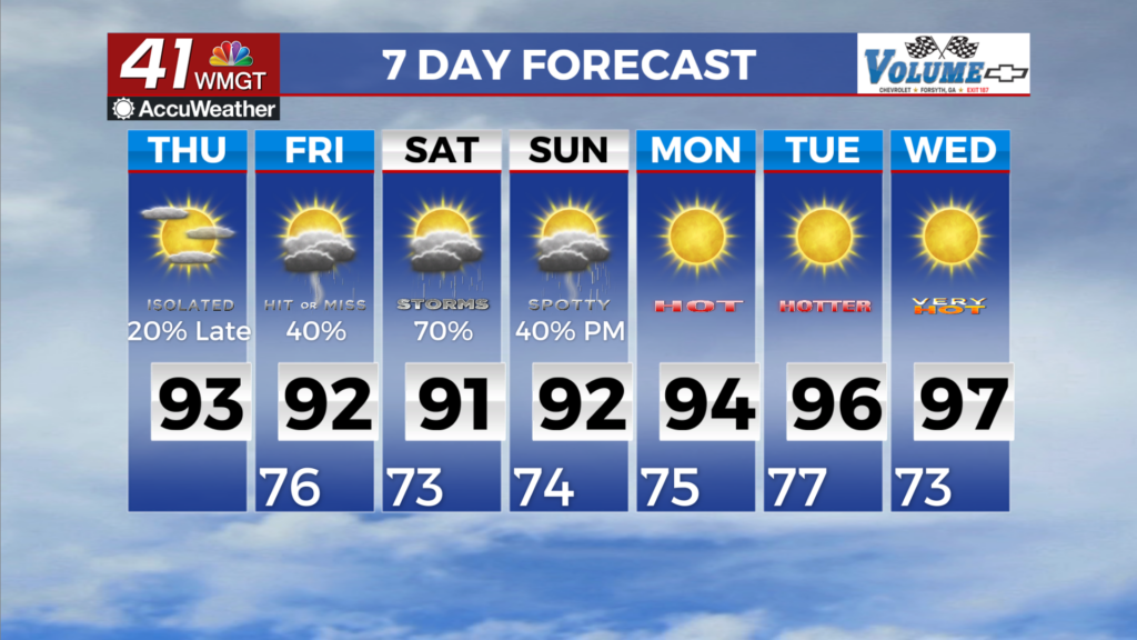
Thursday and Friday will be dry with temperatures in the afternoon topping out in the low 90’s and overnight temperatures falling into the upper 60’s. As we get into the weekend, rain chances begin to go up. Rain coverage late into the weekend and into early next week will depend on the path of Tropical Storm Dorian. Impacts for Middle Georgia right now look to be heavy rainfall early next week.
 Follow Meteorologist Dalton Mullinax on Facebook (Dalton Mullinax 41NBC) and Twitter (@MullinaxWX) for weather updates throughout the day. You can also watch his forecasts Monday through Friday on 41NBC News at Daybreak (5-7 a.m.) and 41Today (11 a.m.).


Leave a Reply