Another frigid night on deck for Middle Georgia before conditions become more mild
MACON, Georgia (41NBC/WGMT) – Overnight lows will drop below freezing again before highs closer to the 60s return Thursday afternoon.
The Rest of the Evening


A thin blanket of upper level clouds has taken over much of the Peach State. Several of those clouds will linger into much of the night, however they will do little to actually act as a blanket and make things warmer. Temperatures will valley in the upper 20s around the region with northeast winds feeding in around 5 mph. A handful of clouds should clear out ahead of Thursday morning.
Tomorrow


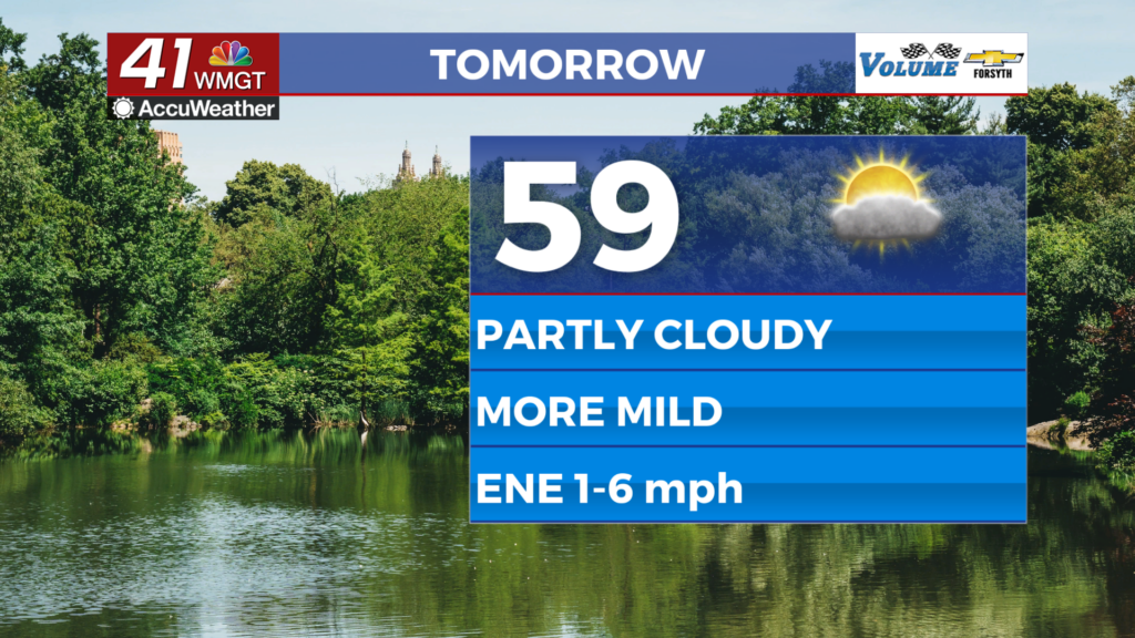
There should be a bit more sun tomorrow afternoon as temperatures largely reach the upper 50s, however overall conditions will likely be partly cloudy. Winds will come from the east at around 5 mph throughout the afternoon. High pressure over the southeast will continue to keep benign weather in the area.


Tomorrow night temperatures will again dip down towards the freezing point around the region under partly cloudy skies. Some thicker clouds may begin to move in ahead of Friday morning. Winds will largely come from the east-northeast at around 5 mph.
Friday and The Weekend


Mostly cloudy skies are likely Friday with temperatures reaching into the lower 60s in the afternoon. Saturday looks a bit nicer right now with partly cloudy skies and highs in the mid to upper 60s. Sunday temperatures should reach the upper 60s under mostly cloudy skies with a few isolated showers possible late (especially overnight). Heavier, more widespread rain is expected to move in on Christmas (Monday), especially over the back half of the day. Afternoon temperatures should stay in the 60s starting this weekend and carrying well into next week.

Follow Meteorologist Aaron Lowery on Facebook (Aaron Lowery 41NBC) and Twitter (@ALowWX) for weather updates throughout the day. Also, you can watch his forecasts Monday through Friday on 41NBC News at 4, 5, 5:30, 6, and 11 PM.