Frigid night ahead for Middle Georgia before conditions begin to warm back up
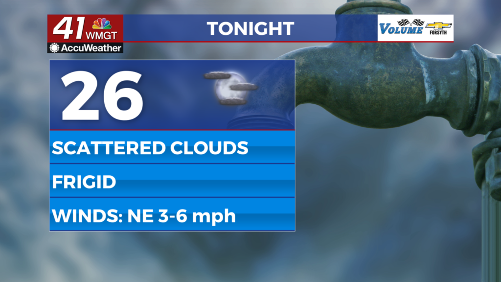
MACON, Georgia (41NBC/WMGT) – Temperatures will dip into the mid to upper 20s overnight around Middle Georgia.
The Rest of the Evening


Clear skies will carry Middle Georgia into the overnight hours with relatively calm winds likely to stick around. They will be from the northeast, however, so a bit of an extra bite is still likely with the frigid conditions tonight. Some scattered cirrus clouds will likely begin to move into the region after midnight. Temperatures will reach their valleys in the mid to upper 20s. A slight drip of the faucet is suggested to avoid any potential plumbing issues.
Tomorrow


Wednesday will be cool and partly sunny around Middle Georgia as a large mass of cirrus clouds passes over the Peach State. Highs will reach the lower 50s around the region with winds blowing generally from the east at around 5 mph.


Overnight many of the cirrus clouds are likely to move out to the east, leading to a clearer start to Thursday morning. It will still be a below freezing night with low temperatures largely dipping into the upper 20s. Winds will continue to feed from the northeast at around 5 mph.
Thursday and Beyond


High temperatures should return to the lower 60s for parts of Middle Georgia by Thursday, and the rest of the region should get there by Friday. Thursday will be mostly sunny while partly cloudy skies are likely both Friday and Saturday. Rain chances begin to jump come Sunday with Christmas on Monday likely to be the next wet day for Middle Georgia. The exact timing of the next rain is still very much up in the air, however, as well as the long term trend to finish off the year.

Follow Meteorologist Aaron Lowery on Facebook (Aaron Lowery 41NBC) and Twitter (@ALowWX) for weather updates throughout the day. Also, you can watch his forecasts Monday through Friday on 41NBC News at 4, 5, 5:30, 6, and 11 PM.