


Zeta regains hurricane strength before landfall late Wednesday
MACON, Georgia. (41NBC/WMGT)- After crossing over the Yucatan Peninsula and briefly losing hurricane strength, Zeta has strengthened back into a hurricane this morning ahead of landfall tonight.
TODAY.
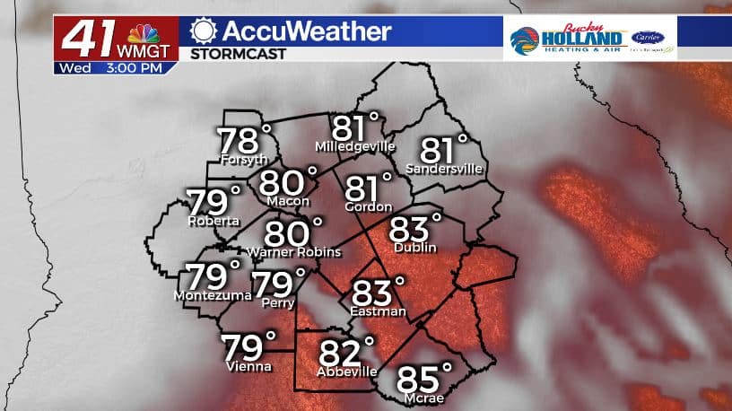
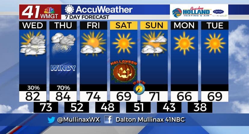
Under a mostly cloudy sky it will be warm and muggy across the state. In Middle Georgia high temperatures will top out in the low 80’s. Isolated showers and storms are possible throughout the day.
TONIGHT.
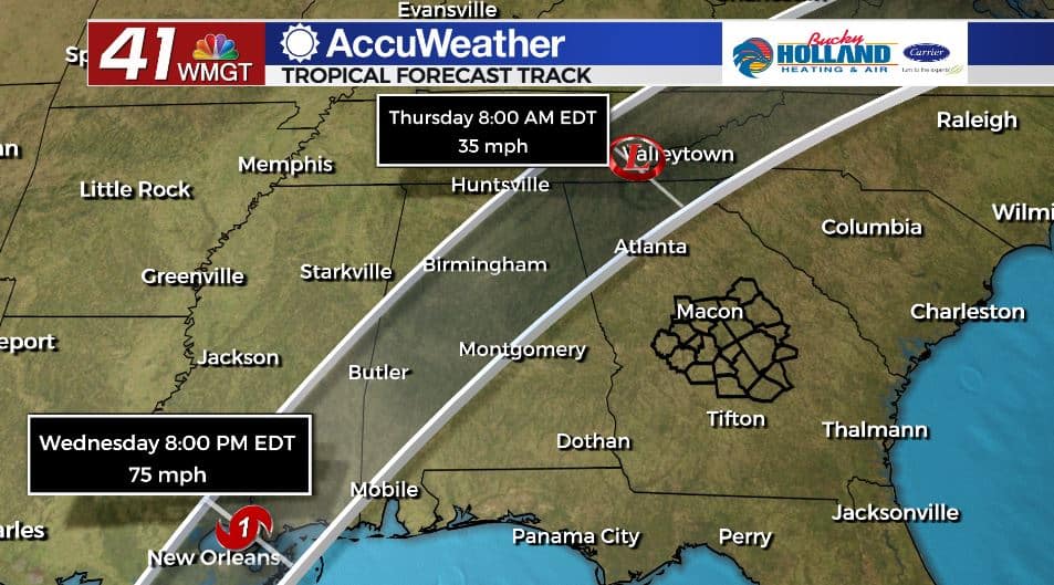
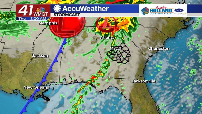
Impacts from Zeta will be felt as early as midnight. The wind will pick up across our area first. By daybreak tomorrow morning we are looking at gusts as high as 50 mph as times as Zeta’s center of circulation moves across northwest Georgia.
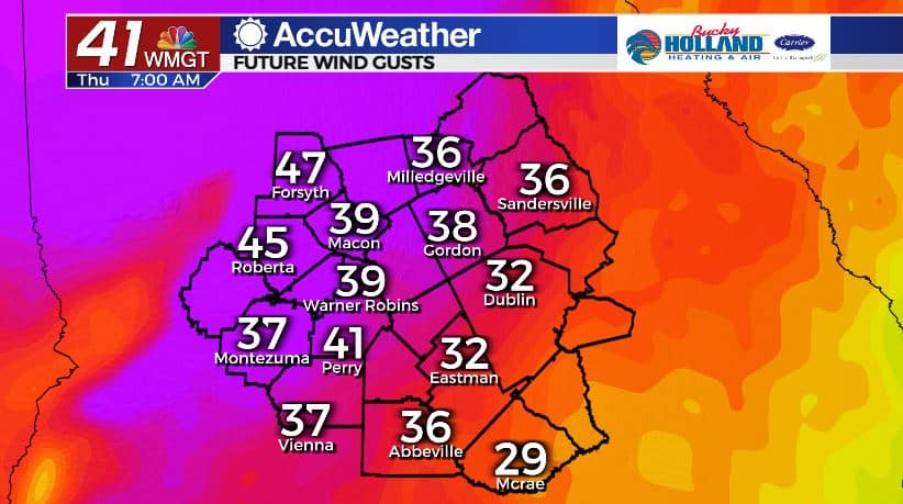
Our main impacts will be gusty winds and the potential for a brief spin-up tornado. That threat will increase through the overnight hours and through lunchtime tomorrow. Downed trees and power lines are likely.
AFTER ZETA.
Zeta will be a quick mover and out of our area by Thursday evening. Behind the system a cold front will move through and MUCH cooler and drier air will settle in just in time for the weekend. Highs on Friday will only be in the low and middle 70’s under a sunny sky. Halloween looks great as well! Temperatures Saturday night will be in the low 50’s.
Follow Meteorologist Dalton Mullinax on Facebook (Dalton Mullinax 41NBC) and Twitter (@MullinaxWX) for weather updates throughout the day. You can also watch his forecasts Monday through Friday on 41NBC News at Daybreak (6-7 a.m.) and 41Today (11 a.m).

Leave a Reply