

Wet weather returns to begin March
MACON, Georgia. (41NBC/WMGT)- Our stretch of dry weather comes to a close on the first day of meteorological spring.
TODAY.
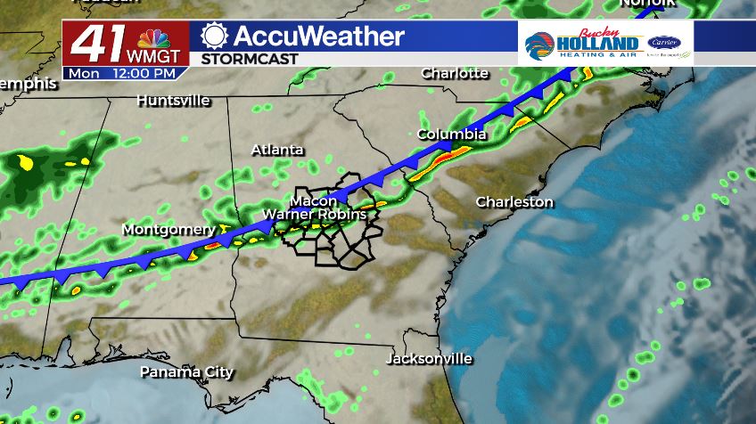
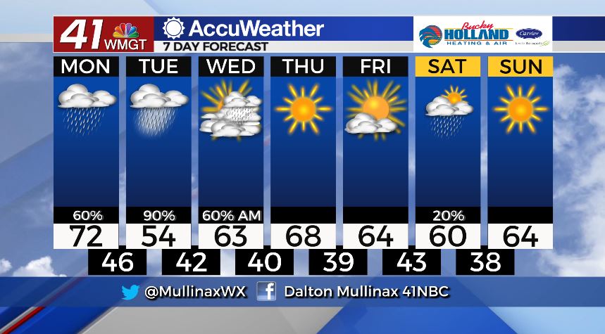
A cold front moving across the state will bring scattered showers to our area today. Temperatures ahead of the front will top out in the low 70’s but will drop steadily throughout the afternoon under a mostly cloudy sky. Isolated showers are likely overnight as temperatures fall into the middle and upper 40’s.
TOMORROW.
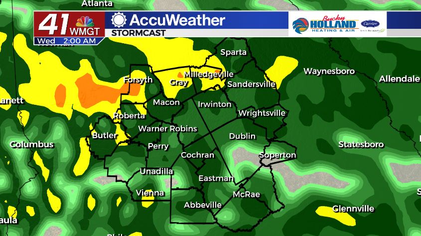
A few showers are possible throughout the day tomorrow, but the bulk of the rain will begin to fall late Tuesday night. Temperatures tomorrow will only top out in the middle 50’s under a cloudy sky. Overnight lows are expected in the low 40’s.
WEEK AHEAD.
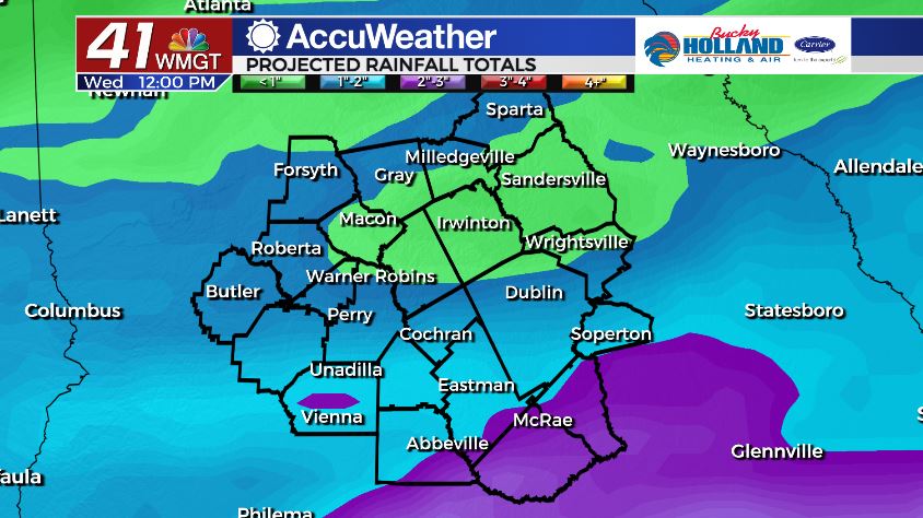
Heavy rain starting late Tuesday will continue through midday Wednesday. 1-3″ of rain is possible between now and then. Past Wednesday we will begin to clear out. Outside of an isolated rain chance on Saturday the back half of the 7 Day forecast looks dry!
Follow Meteorologist Dalton Mullinax on Facebook (Dalton Mullinax 41NBC) and Twitter (@MullinaxWX) for weather updates throughout the day. You can also watch his forecasts Monday through Friday on 41NBC News at Daybreak (6-7 a.m.) and 41Today (11 a.m).


Leave a Reply